Mesoscale Discussion 2283
Issued: · Valid: –
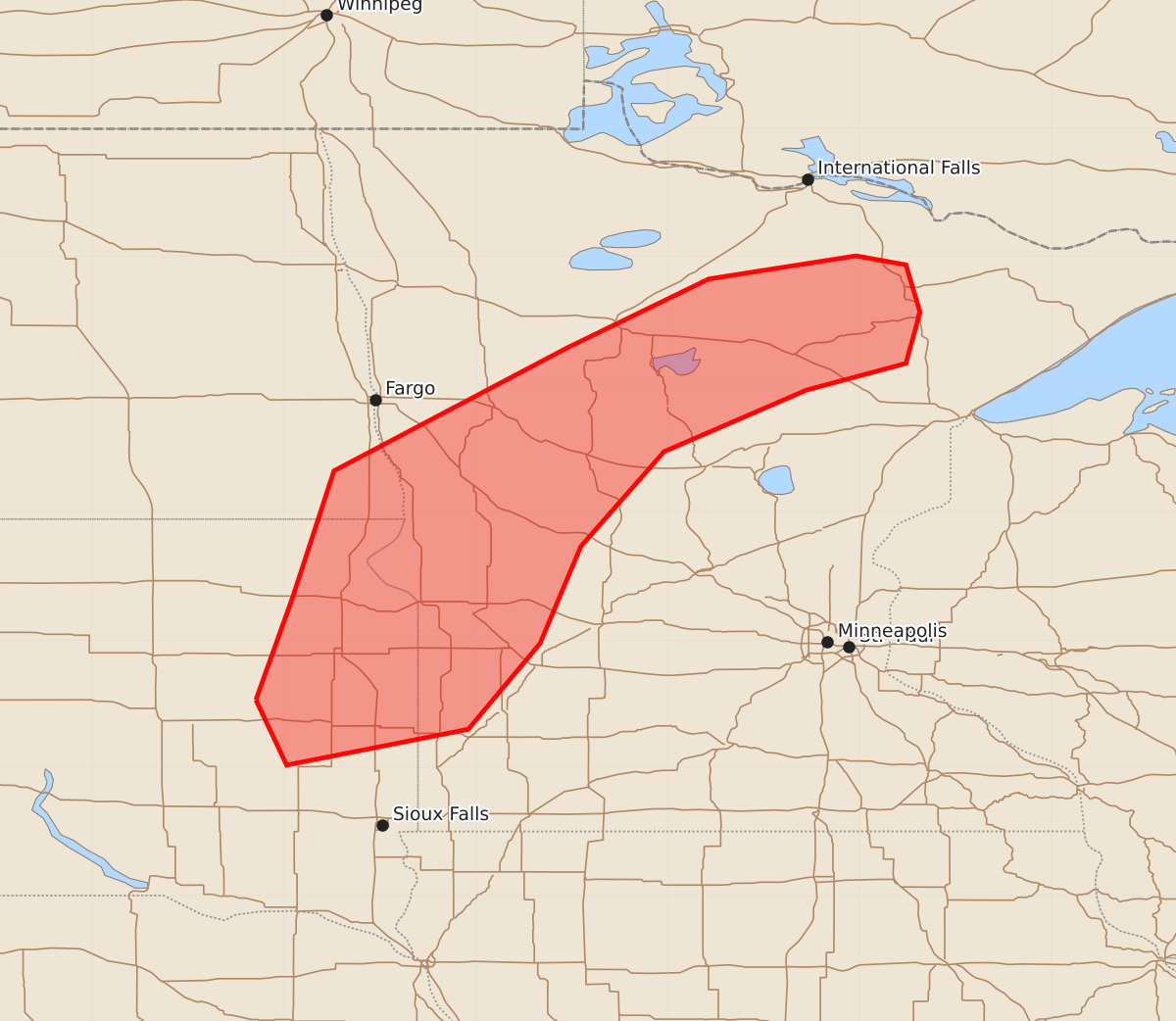
Summary
Severe storms capable of producing large hail, damaging winds, and tornadoes are expected this evening across eastern South Dakota and into north-central Minnesota.
Product Text
000 ACUS11 KWNS 112051 SWOMCD SPC MCD 112051 MNZ000-SDZ000-NDZ000-112145- Mesoscale Discussion 2283 NWS Storm Prediction Center Norman OK 0351 PM CDT Fri Sep 11 2026 Areas affected...eastern South Dakota into north-central Minnesota. Concerning...Severe potential...Watch likely Valid 112051Z - 112145Z Probability of Watch Issuance...80 percent SUMMARY...Severe storms are expected this evening. All severe weather hazards are possible. DISCUSSION...SPC HRRR-based mesoanalysis shows eroding inhibition ahead of a cold front across west-central Minnesota and into northeast South Dakota. Surface-based cumulus evolution has been mostly masked by mid-level cloud cover across the region. However, some surface-based cumulus can be seen across eastern South Dakota where breaks in the mid-level cloud deck are present. The lack of more clear satellite imagery along the front is resulting in uncertainty on storm timing. Expect storms to be along the front where convergence is maximized. The latest HRRR shows storm development between 23Z and 00Z. However, the elevated storms across northeast Minnesota developed 1 to 2 hours earlier than the latest HRRR forecast. Given the presence of cu across the area and an uncapped warm sector (per SPC mesoanalysis), combined with slightly earlier timing from the elevated storms, expect storm development along the front between 21Z and 22Z. 2000-2500 J/kg MLCAPE and effective shear around 35 to 40 knots will support organized storms and a threat for large hail (some 2+ inches) and damaging wind gusts. Low-level shear will support a tornado threat, but storm mode may quickly go linear which may limit the overall threat, despite veering low-level flow and moderate speed shear. A watch will likely be needed later this evening. ..Bentley/Guyer.. 09/11/2026 ...Please see www.spc.noaa.gov for graphic product... ATTN...WFO...DLH...MPX...FGF...FSD...ABR... LAT...LON 44539772 45349743 46329711 47289529 47829418 48009303 47939264 47569253 47169264 46959342 46479453 45739518 44979550 44309606 44029748 44539772 MOST PROBABLE PEAK TORNADO INTENSITY...85-110 MPH MOST PROBABLE PEAK WIND GUST...55-70 MPH MOST PROBABLE PEAK HAIL SIZE...1.50-2.50 IN