Mesoscale Discussion 2287
Issued: · Valid: –
Summary
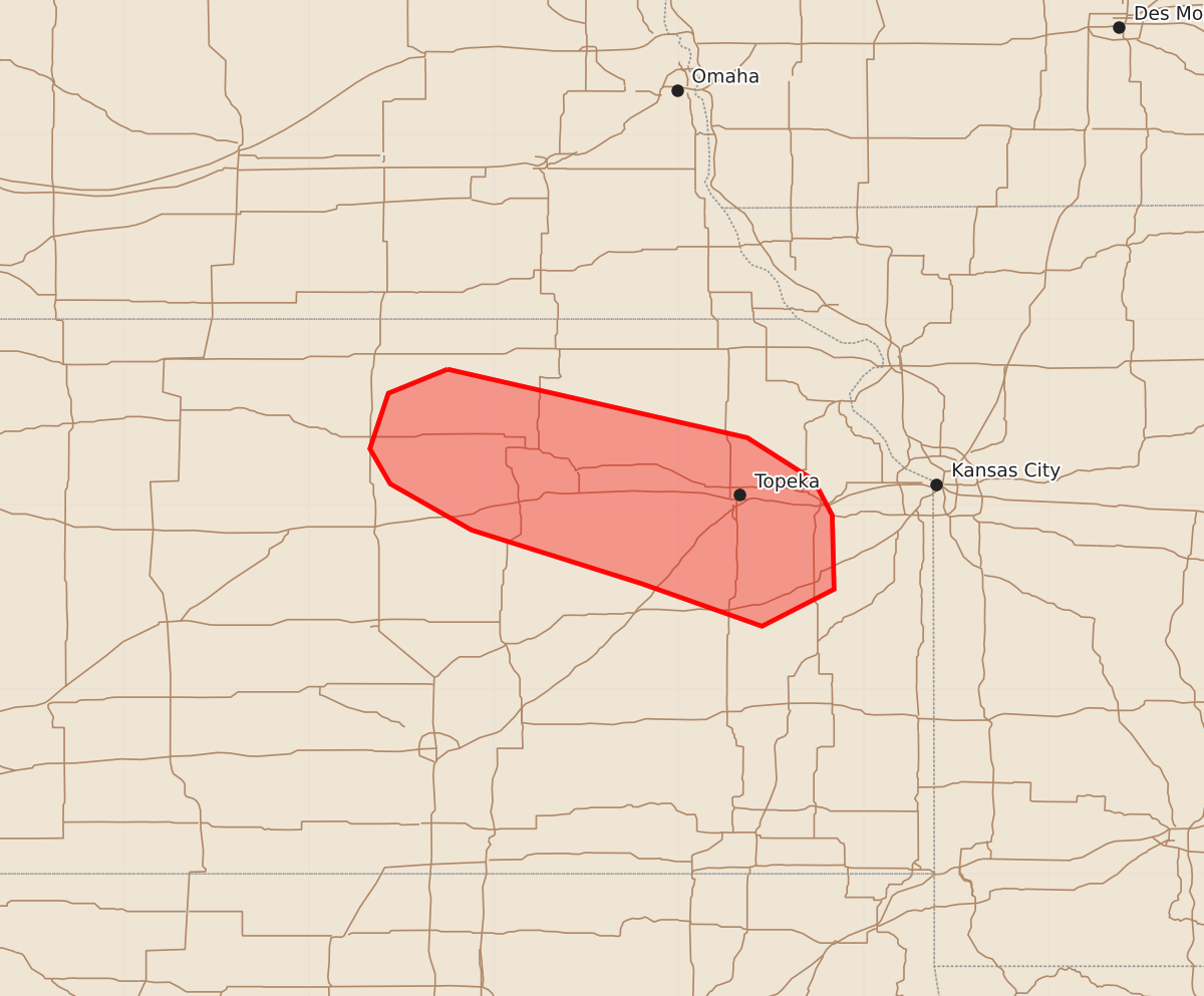
Marginally severe hail and wind may develop across most of northeast Kansas and western Missouri this evening. Expected hazards include wind gusts of 55 to 70 mph and hail up to 2.50 inches.
Product Text
000 ACUS11 KWNS 122044 SWOMCD SPC MCD 122044 KSZ000-122215- Mesoscale Discussion 2287 NWS Storm Prediction Center Norman OK 0344 PM CDT Sat Sep 12 2026 Areas affected...northeast Kansas Concerning...Severe potential...Watch possible Valid 122044Z - 122215Z Probability of Watch Issuance...40 percent SUMMARY...A corridor of at least marginally severe hail or wind may develop across most of northeast Kansas, perhaps western Missouri this evening. DISCUSSION...Despite northeasterly boundary-layer winds and cool temperatures, sporadic elevated storms have affected the region for much of the day. Recently, a stronger/larger area of storms has developed, and produced a wind gust of 51 kt at Concordia, KS. Models suggest up to 2000 J/kg elevated MUCAPE is present currently. Aiding storm intensity are steep lapse rates aloft and favorable effective shear over 40 kt. Given the size of the existing storm cluster, this zone bears watching, with possible watch consideration downstream over the next hour or so. ..Jewell/Guyer.. 09/12/2026 ...Please see www.spc.noaa.gov for graphic product... ATTN...WFO...EAX...TOP... LAT...LON 39739725 39369563 39139527 38949517 38549516 38349555 38579620 38869712 39119756 39309767 39609757 39739725 MOST PROBABLE PEAK WIND GUST...55-70 MPH MOST PROBABLE PEAK HAIL SIZE...1.50-2.50 IN