Mesoscale Discussion 1828
Issued: · Valid: –
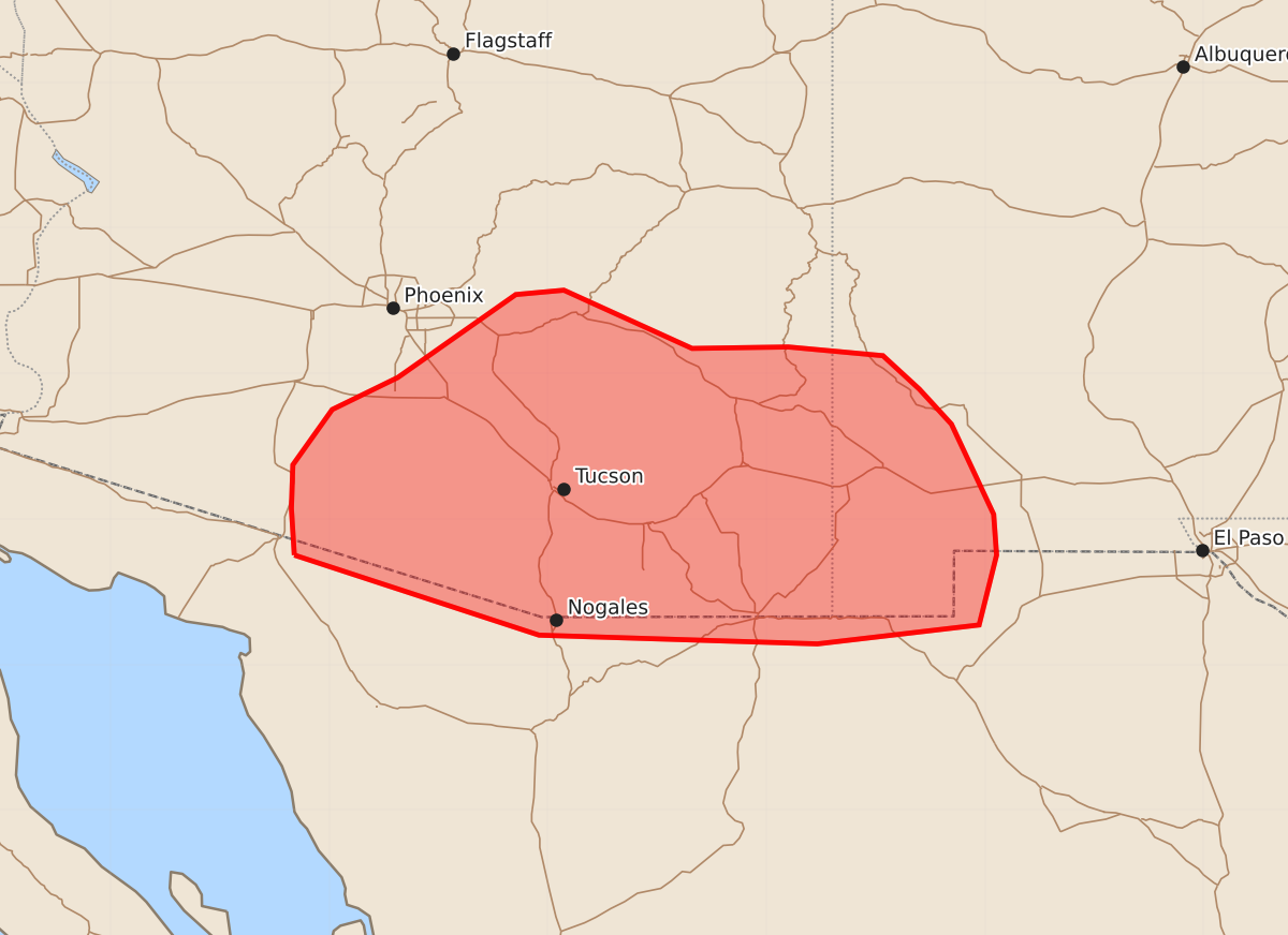
Summary
Scattered to numerous thunderstorms capable of producing severe wind gusts and isolated hail are expected across portions of southern Arizona and southwest New Mexico this afternoon and evening. These storms may pose a severe risk as they move through the higher terrain toward the Mexican border.
Product Text
000 ACUS11 KWNS 032022 SWOMCD SPC MCD 032021 NMZ000-AZZ000-032215- Mesoscale Discussion 1828 NWS Storm Prediction Center Norman OK 0321 PM CDT Mon Aug 03 2026 Areas affected...portions of southern Arizona and southwest New Mexico Concerning...Severe potential...Watch possible Valid 032021Z - 032215Z Probability of Watch Issuance...40 percent SUMMARY...Scattered to numerous thunderstorms are expected across the higher terrain of southeastern AZ and far southwest NM this afternoon and evening. Steep lapse rates and some clustering will promote strong downdrafts with severe gusts possible. The need for a WW is unclear, but could be necessary later today. DISCUSSION...As of 2015 UTC, visible and radar imagery showed initial thunderstorms had developed over the higher terrain of the southern Mogollon Rim. Additional deepening cumulus was noted across the ranges of southern AZ and southwest NM as the air mass has warmed. Continued heating (surface temps of 90-105 F) is supporting air mass destabilization with MLCAPE of 1000-1500 J/kg, increasing to near 2000 J/kg later today. As inhibition decreases the current storms are expected to intensify, with additional development likely in the next couple of hours from strengthening orographic circulations and the breaching of convective temperatures. As convection gradually matures this afternoon, modest northeasterly mid-level flow on the southern periphery of the upper ridge may allow storms to move off the higher terrain. The steep lapse rates in the lowest few km and some cold pool aggregation should promote strong downdrafts, with severe-caliber gusts possible. Isolated hail may also occur with the initial stronger updrafts given the moderate buoyancy. However, the lack of more robust mid-level flow and forcing suggests a generally slower convective evolution and more limited organization potential. CAM and AI/ML guidance do show the potential for one or more clusters to move south/southwest toward the Mexican border through this evening with an attendant severe risk. While the need for a watch is unclear, convective trends will be monitored. ..Lyons/Gleason.. 08/03/2026 ...Please see www.spc.noaa.gov for graphic product... ATTN...WFO...EPZ...TWC...PSR... LAT...LON 31751274 32071276 32371275 32751248 32971203 33541122 33571089 33171001 33180935 33120870 32890845 32650823 32030794 31750792 31270804 31140915 31201106 31751274 MOST PROBABLE PEAK WIND GUST...65-80 MPH MOST PROBABLE PEAK HAIL SIZE...UP TO 1.25 IN