Mesoscale Discussion 1872
Issued: · Valid: –
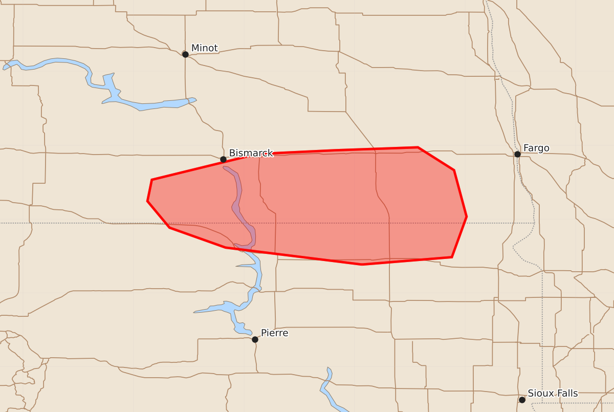
Summary
Isolated severe thunderstorms capable of producing damaging wind gusts and large hail may develop over portions of southern and eastern North Dakota and far northern South Dakota through early evening. Severe impacts could include wind gusts up to 70 mph and hail as large as 2.5 inches.
Product Text
000 ACUS11 KWNS 090009 SWOMCD SPC MCD 090008 NDZ000-SDZ000-090145- Mesoscale Discussion 1872 NWS Storm Prediction Center Norman OK 0708 PM CDT Sat Aug 08 2026 Areas affected...portions of southern and eastern North Dakota into far northern South Dakota Concerning...Severe potential...Watch unlikely Valid 090008Z - 090145Z Probability of Watch Issuance...20 percent SUMMARY...A few instances of severe wind/hail may occur with storms that can mature over the next few hours. The severe threat should remain isolated, so a WW issuance is not anticipated. DISCUSSION...Multicellular storms/possible LP supercells have attempted to intensify over the past hour. The initial attempts at stronger convection have produced outflow to the southwest, where localized convergence is allowing for additional attempts at initiation to occur. At the moment, it is unclear if these initial storms will pose the primary threat for severe wind/hail, or if the greater severe threat will manifest from later storms this evening (per high-resolution guidance consensus). Uncertainty in convective evolution is heightened further by the presence of smoke overspreading the warm sector, which may inhibit convective development and intensification. Nonetheless, under the condition that a thunderstorm should intensify further and become sustained, the presence of 1000-2500 J/kg MLCAPE amid 50-60 kts of effective bulk shear is adequate in supporting supercell structures capable of producing severe wind and hail (with an instance or two of 2+ inch diameter hail possible). ..Squitieri/Mosier.. 08/09/2026 ...Please see www.spc.noaa.gov for graphic product... ATTN...WFO...FGF...ABR...BIS... LAT...LON 45389890 45610075 45880151 46240181 46530175 46880032 46939926 46979814 46669765 46039748 45489768 45389890 MOST PROBABLE PEAK WIND GUST...55-70 MPH MOST PROBABLE PEAK HAIL SIZE...1.50-2.50 IN