Mesoscale Discussion 2276
Issued: · Valid: –
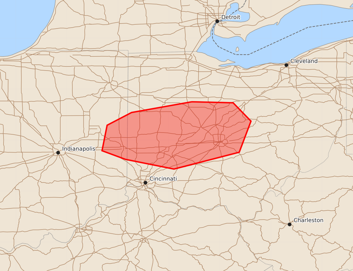
Summary
Isolated strong to severe wind gusts are possible across far eastern Indiana and western to central Ohio this evening.
Product Text
000 ACUS11 KWNS 092318 SWOMCD SPC MCD 092318 OHZ000-INZ000-100115- Mesoscale Discussion 2276 NWS Storm Prediction Center Norman OK 0618 PM CDT Wed Sep 09 2026 Areas affected...far eastern Indiana into western/central Ohio Concerning...Severe potential...Watch unlikely Valid 092318Z - 100115Z Probability of Watch Issuance...20 percent SUMMARY...Isolated strong to severe gusts will be possible with storms developing near the cold front this evening. DISCUSSION...Thunderstorm development is noted near the cold front across far eastern Indiana into western/central Ohio. While a narrow axis of marginal to moderate instability remains ahead of the front, deep layer flow decreases with southern extent into central/southern Ohio as the primary region of mid-level flow is moving off to the northeast. Temperatures in the mid to upper 80s across southern/central Ohio are supporting steep low-level lapse rates but temperatures will continue to gradually cool this evening. A few instances of strong to severe wind may be possible before sunset. Given the likely short duration and isolated threat, a watch is unlikely to be needed. ..Thornton/Smith.. 09/09/2026 ...Please see www.spc.noaa.gov for graphic product... ATTN...WFO...CLE...ILN...IWX...IND... LAT...LON 40758355 40548473 40298521 39798531 39628485 39438390 39768262 40378239 40738274 40758355 MOST PROBABLE PEAK WIND GUST...55-70 MPH