Mesoscale Discussion 2007
Issued: · Valid: –
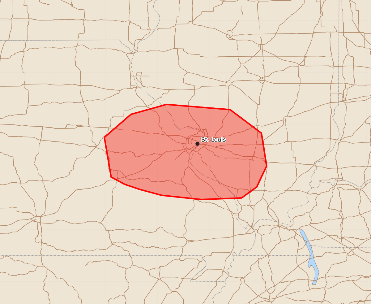
Summary
Isolated severe thunderstorms capable of producing damaging wind gusts and hail may affect portions of eastern Missouri and western Illinois this evening. These storms are expected to be scattered, with peak wind gusts up to 60 mph and hail up to 1.25 inches.
Product Text
000 ACUS11 KWNS 170128 SWOMCD SPC MCD 170127 ILZ000-MOZ000-170300- Mesoscale Discussion 2007 NWS Storm Prediction Center Norman OK 0827 PM CDT Sun Aug 16 2026 Areas affected...portions of eastern Missouri into western Illinois Concerning...Severe potential...Watch unlikely Valid 170127Z - 170300Z Probability of Watch Issuance...20 percent SUMMARY...A few instances of damaging gusts or hail may accompany the stronger storms this evening. The severe threat is expected to be isolated, so a WW issuance is not currently anticipated. DISCUSSION...Thunderstorms have been gradually intensifying across central and eastern MO along remnant outflow boundaries with the peak of PBL mixing/destabilization. Despite this fact, nocturnal cooling is underway, with MLCINH on the increase per 01Z mesoanalysis. Still, residual buoyancy, driven by rich low-level moisture (i.e. mid 70s F surface dewpoints) yields over 3000 J/kg MLCAPE amid 30-40 kts of effective bulk shear. This parameter space would support multicells and transient supercells capable of some damaging gusts and hail. This threat is quite conditional on the large scale given the aforementioned stabilization underway, though a locally greater severe threat exists with storms that can anchor along a boundary that roughly bisects the St. Louis metro. Nonetheless, given the overall expected sparse nature of the severe threat, a Severe Thunderstorm Watch issuance is not expected. ..Squitieri/Gleason.. 08/17/2026 ...Please see www.spc.noaa.gov for graphic product... ATTN...WFO...PAH...LSX...SGF... LAT...LON 38769202 39209151 39399083 39298961 38848901 38218891 37818910 37608939 37579016 37659092 37769133 37869163 38009189 38769202 MOST PROBABLE PEAK WIND GUST...UP TO 60 MPH MOST PROBABLE PEAK HAIL SIZE...UP TO 1.25 IN