Mesoscale Discussion 1591
Issued: · Valid: –
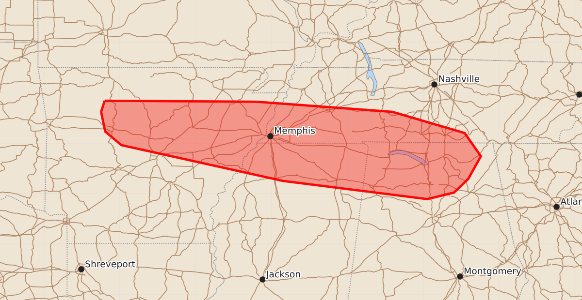
Summary
Strong wind gusts and severe thunderstorms are expected across northern Arkansas, southern Middle Tennessee, and northern Alabama through this evening. These storms may produce damaging wind gusts between 55 and 70 mph and hail up to 1.25 inches.
Product Text
000 ACUS11 KWNS 112038 SWOMCD SPC MCD 112038 ALZ000-TNZ000-MSZ000-ARZ000-112245- Mesoscale Discussion 1591 NWS Storm Prediction Center Norman OK 0338 PM CDT Sat Jul 11 2026 Areas affected...northern Arkansas into southern Middle Tennessee and northern Alabama Concerning...Severe Thunderstorm Watch 482... Valid 112038Z - 112245Z The severe weather threat for Severe Thunderstorm Watch 482 continues. SUMMARY...Strong to severe gusts remain possible through this evening across the watch area, and may eventually occur east of the watch into northern Alabama and southern Middle Tennessee. DISCUSSION...Storms have developed along the front this afternoon, extending across northern AR and into western TN. Strong wind gusts have been reported, with a peak wind of 47 kt measured at KMKL at 2009Z. The air mass remains strongly unstable across the entire watch area, and westerly winds have also warmed temperatures above 90 F into Middle TN and northern AL. As such, corridors of damaging gusts appear likely as stronger sections of the line bow toward the southeast. Additional activity has developed near the eastern edge of the watch into southern parts of Middle TN where the air mass has recovered. Depending on storm trends, a new watch may be considered east/downstream of WW482 later today. ..Jewell.. 07/11/2026 ...Please see www.spc.noaa.gov for graphic product... ATTN...WFO...OHX...BMX...HUN...MEG...LZK... LAT...LON 35849330 35829029 35628761 35208618 34748586 34298611 34028639 33898692 34258977 34969297 35239329 35629337 35849330 MOST PROBABLE PEAK WIND GUST...55-70 MPH MOST PROBABLE PEAK HAIL SIZE...UP TO 1.25 IN