Mesoscale Discussion 2142
Issued: · Valid: –
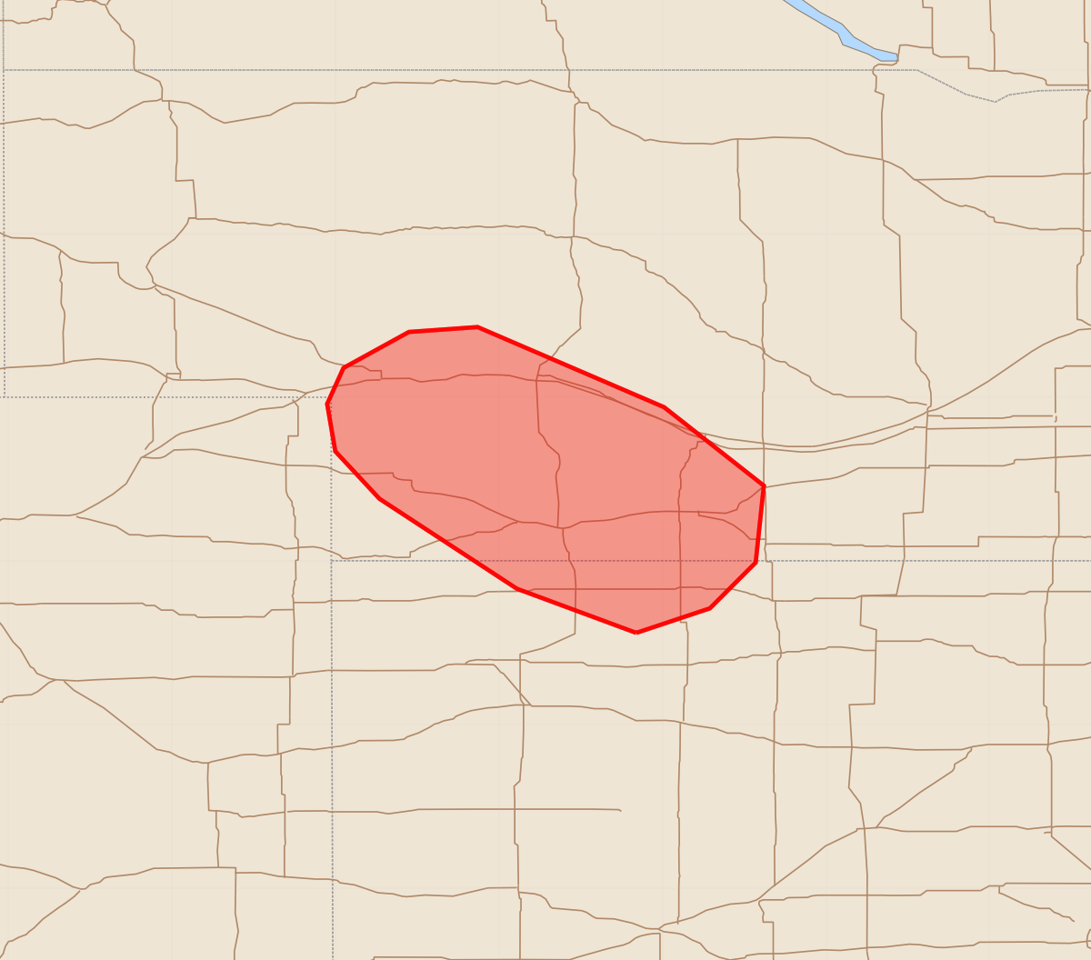
Summary
Isolated thunderstorms capable of producing large hail and severe wind gusts are possible for parts of southwestern Nebraska and far northwestern Kansas through the next couple of hours. These storms may produce wind gusts of 55-70 mph and hail up to 1.75 inches.
Product Text
000 ACUS11 KWNS 262155 SWOMCD SPC MCD 262154 KSZ000-NEZ000-COZ000-262330- Mesoscale Discussion 2142 NWS Storm Prediction Center Norman OK 0454 PM CDT Wed Aug 26 2026 Areas affected...Parts of southwestern NE into far northwestern KS Concerning...Severe potential...Watch possible Valid 262154Z - 262330Z Probability of Watch Issuance...40 percent SUMMARY...Isolated instances of large hail and locally severe wind gusts will be possible for the next couple hours or so. Storm coverage may remain too limited for a watch, though trends are being monitored. DISCUSSION...Within a zone of broadly confluent low-level flow across parts of southwestern NE, diurnal heating amid lower 60s dewpoints has aided in the development of isolated thunderstorms this afternoon. A long/straight hodograph (around 35-40 kt of effective shear) and steep midlevel lapse rates/moderate surface-based buoyancy may continue to promote splitting supercells and a risk of large hail and locally severe wind gusts. Given minimal large-scale forcing for ascent, overall storm coverage may remain too limited for a watch. However, given the favorable environment and ongoing mode evolution, trends are being monitored. ..Weinman/Smith.. 08/26/2026 ...Please see www.spc.noaa.gov for graphic product... ATTN...WFO...GID...LBF...GLD...BOU... LAT...LON 39560016 39830089 40380173 40670200 40960205 41180195 41400155 41430113 40949999 40469938 39999943 39719971 39560016 MOST PROBABLE PEAK WIND GUST...55-70 MPH MOST PROBABLE PEAK HAIL SIZE...1.00-1.75 IN