Mesoscale Discussion 2053
Issued: · Valid: –
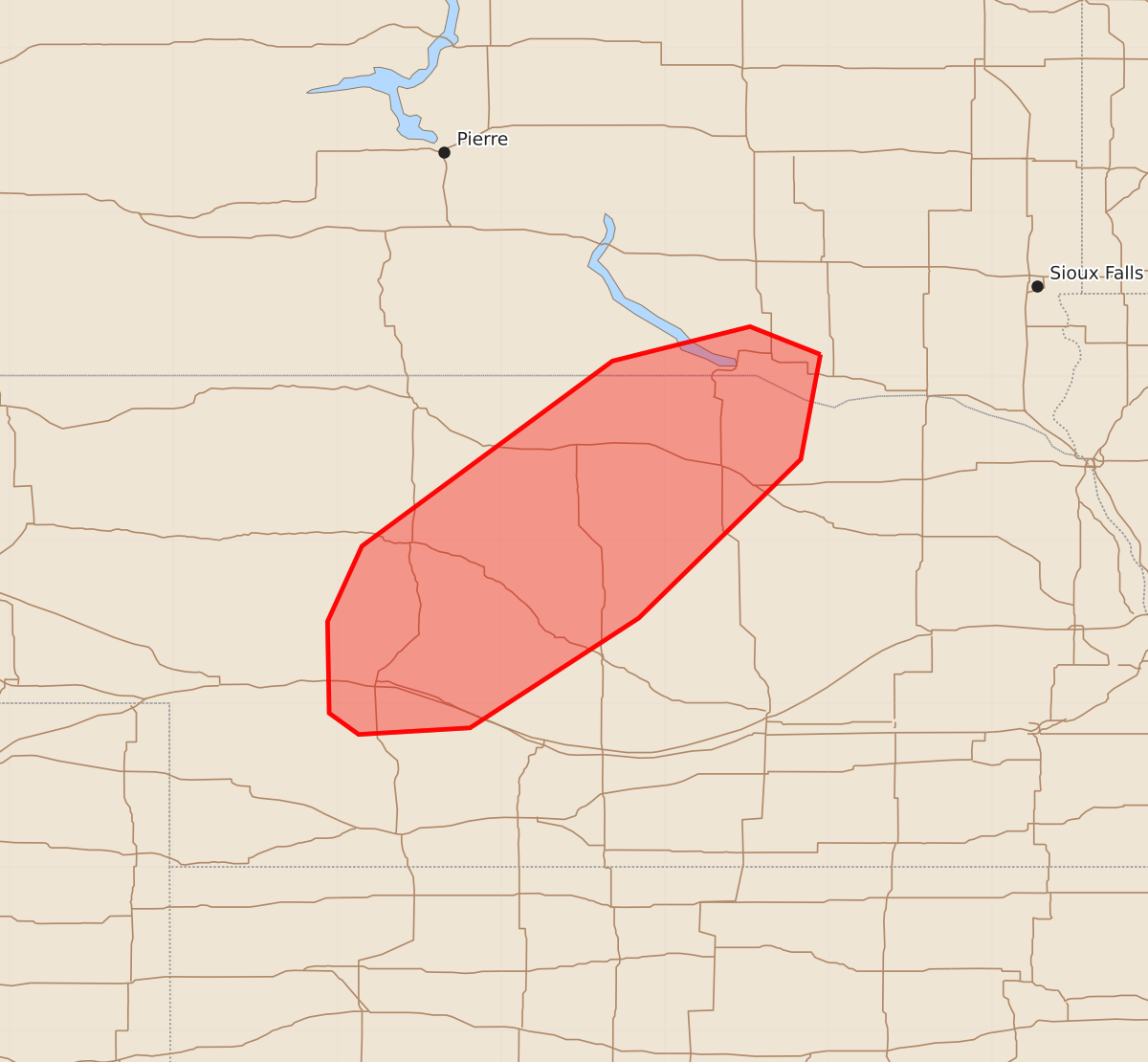
Summary
Isolated to scattered thunderstorms may produce large hail and severe winds across central Nebraska and southeast South Dakota this afternoon.
Product Text
000 ACUS11 KWNS 201950 SWOMCD SPC MCD 201949 NEZ000-SDZ000-202145- Mesoscale Discussion 2053 NWS Storm Prediction Center Norman OK 0249 PM CDT Thu Aug 20 2026 Areas affected...Central Nebraska into southeast South Dakota Concerning...Severe potential...Watch possible Valid 201949Z - 202145Z Probability of Watch Issuance...40 percent SUMMARY...Isolated to widely scattered storms may produce large hail and severe winds this afternoon. Limited coverage may preclude watch issuance, though trends will be monitored through the afternoon. DISCUSSION...Weak thunderstorms have recently initiated within Cherry County, NE this afternoon along a weak surface trough. Moisture return continues into the central Plains along the western flank of a surface high. Dewpoints have generally held in the low/mid 60s F despite the strong heating/mixing. Given the mid-level height rises that are occurring, storm coverage/longevity is in question. With around 40 kt of effective shear and modestly steep mid-level lapse rates on the 18Z LBF sounding, mature/sustained storms would likely be supercellular and capable of large hail (up to around 2 in.) and severe wind gusts. It is not clear whether a watch will be needed this afternoon given potentially isolated coverage. However, convective trends will continue to be monitored. ..Wendt/Smith.. 08/20/2026 ...Please see www.spc.noaa.gov for graphic product... ATTN...WFO...FSD...OAX...GID...LBF... LAT...LON 43139805 42499817 41529916 40850019 40810087 40940105 41500106 41960085 43099932 43309848 43139805 MOST PROBABLE PEAK TORNADO INTENSITY...UP TO 90 MPH MOST PROBABLE PEAK WIND GUST...65-80 MPH MOST PROBABLE PEAK HAIL SIZE...1.50-2.50 IN