Mesoscale Discussion 1583
Issued: · Valid: –
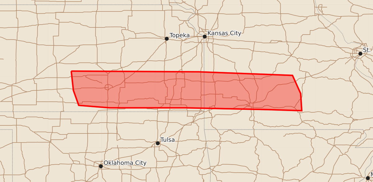
Summary
Strong to locally severe storms capable of producing damaging wind gusts and isolated hail are possible across southeast Kansas and southwest Missouri through the early overnight hours.
Product Text
000 ACUS11 KWNS 110337 SWOMCD SPC MCD 110336 MOZ000-KSZ000-110530- Mesoscale Discussion 1583 NWS Storm Prediction Center Norman OK 1036 PM CDT Fri Jul 10 2026 Areas affected...South-central/southeast KS into southwest MO Concerning...Severe potential...Watch unlikely Valid 110336Z - 110530Z Probability of Watch Issuance...20 percent SUMMARY...Strong to locally severe storms are possible into the early overnight hours. DISCUSSION...Storms have recently developed in the vicinity of a remnant surface boundary from southeast KS into southwest MO. This convection is likely somewhat elevated, but rich moisture (with PW near 2 inches) and moderate MUCAPE will continue to favor robust updrafts into the early overnight hours. Effective shear is generally modest (around 25-30 kt), which may tend to limit the longevity and intensity of any particular storm. However, localized downbursts and isolated hail cannot be ruled out with the strongest cells. Storm interactions and gradually increasing low-level warm advection may eventually result in one or two loosely organized clusters, though the remaining severe threat is currently expected to remain rather localized. ..Dean/Thompson.. 07/11/2026 ...Please see www.spc.noaa.gov for graphic product... ATTN...WFO...SGF...EAX...TOP...ICT... LAT...LON 38149835 38129477 38029214 37519191 37039188 37069281 37119514 37119727 37189814 37609829 38149835 MOST PROBABLE PEAK WIND GUST...55-70 MPH MOST PROBABLE PEAK HAIL SIZE...UP TO 1.25 IN