Mesoscale Discussion 1661
Issued: · Valid: –
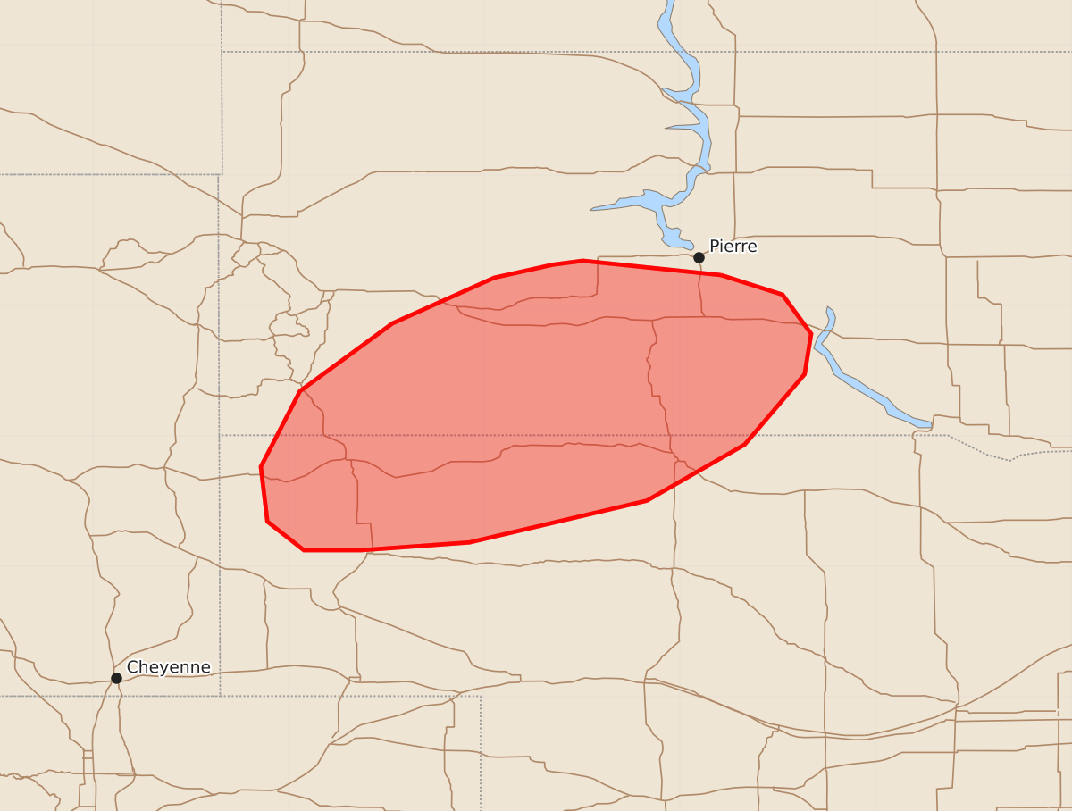
Summary
Isolated damaging wind gusts may occur across portions of the Black Hills into south-central South Dakota and northern Nebraska through this evening. These winds are expected to reach speeds of 55 to 70 mph.
Product Text
000 ACUS11 KWNS 192030 SWOMCD SPC MCD 192030 NEZ000-SDZ000-192230- Mesoscale Discussion 1661 NWS Storm Prediction Center Norman OK 0330 PM CDT Sun Jul 19 2026 Areas affected...portions of the Black Hills into south-central South Dakota and northern Nebraska Concerning...Severe potential...Watch unlikely Valid 192030Z - 192230Z Probability of Watch Issuance...20 percent SUMMARY...Some potential for damaging/severe wind gusts may accompany developing, high-based convection through this evening. DISCUSSION...Latest visible satellite imagery depicts a field of towering cumulus with recent lightning activity across portions of southwestern South Dakota. Modifying the nearby 18z UNR observed sounding for nearby observations depicts a deep, well-mixed boundary layer with steep low-level lapse rates, 500 to 750 J/kg MLCAPE, and LCLs around 3 km AGL. This thermodynamic environment will support high-based convection, with some potential for isolated damaging/severe wind gusts likely to evolve through the afternoon/evening given surface dewpoint depressions of 40-50 F. Latest high-res guidance suggests that some clustering of convection along developing cold pools may occur over the next several hours; however, uncertainty remains regarding the longevity of this convection. With this activity occurring along the southern periphery of stronger mid-to-upper level flow, effective shear is limited to around 20-25 kts per latest mesoanalysis. This lends some credence to a more limited severe risk compared to areas farther north. Thus, watch issuance appears unlikely at this time but could be considered should a longer duration risk for damaging/severe wind gusts evolve through this afternoon and evening. ..Chalmers/Thompson.. 07/19/2026 ...Please see www.spc.noaa.gov for graphic product... ATTN...WFO...ABR...LBF...UNR...CYS... LAT...LON 44230018 44089971 43789949 43479954 42930000 42500075 42180211 42120294 42120338 42340366 42760371 43340341 43860270 44210192 44310147 44340124 44230018 MOST PROBABLE PEAK WIND GUST...55-70 MPH