Day 2 Convective Outlook
Issued: · Valid: –
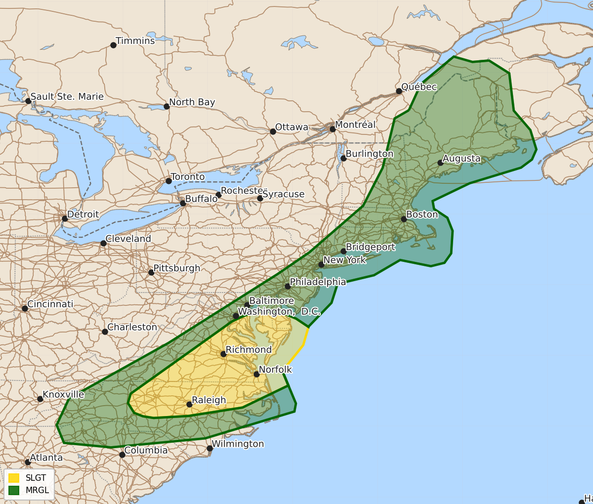
Summary
Isolated severe thunderstorms capable of producing damaging wind gusts and a possible tornado are expected across the southern Mid-Atlantic and Carolinas on Wednesday afternoon. Some thunderstorms in New England may also produce locally strong wind gusts throughout the day.
Product Text
000 ACUS02 KWNS 211730 SWODY2 SPC AC 211728 Day 2 Convective Outlook NWS Storm Prediction Center Norman OK 1228 PM CDT Tue Jul 21 2026 Valid 221200Z - 231200Z ...THERE IS A SLIGHT RISK OF SEVERE THUNDERSTORMS ACROSS THE SOUTHERN MID-ATLANTIC... ...SUMMARY... Isolated severe thunderstorms will pose a risk for damaging wind gusts across parts of the southern Mid-Atlantic. Additional thunderstorms are expected northward across New England, some of which could produce locally strong wind gusts. ...Synopsis... The pattern on D2/Wednesday will be characterized by upper-level ridging across western US with a more progressive wave pattern within a trough across the eastern US. A cold front will be located roughly from the Mid-Atlantic south into the Carolinas and western Tennessee. This will be the focus of thunderstorm development and severe potential Wednesday afternoon. ...Mid-Atlantic into New England... Morning cloud cover will extend across New England to the Mid-Atlantic Wednesday morning, which will likely temper heating and destabilization with northern extent into New England. More filtered heating through broken cloud cover in combination with moist southerly flow should yield moderate instability across portions of the southern Mid-Atlantic. This in combination with strong mid-level flow and resulting strong deep layer shear will support potential for a few organized storms/clusters capable of producing damaging winds and perhaps a tornado. Highest confidence in this potential will extend from the Carolinas to southern Delaware, where strongest heating is anticipated. Strong deep layer shear will extend northward into New England, which may support isolated stronger storms with potential for damaging wind though instability becomes less favorable further north. ...Eastern Colorado... High based thunderstorms are expected to develop across the high terrain in eastern Colorado Wednesday afternoon. Marginally unstable and deeply mixed profiles may support a few instances of strong to severe wind. Overall, weak deep layer shear profiles will likely keep this threat too limited for probabilities to be included at this time. ..Thornton.. 07/21/2026 $$