Mesoscale Discussion 1714
Issued: · Valid: –
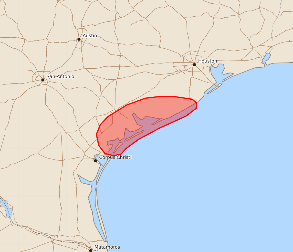
Summary
Isolated severe wind gusts of 55 to 70 mph may occur along portions of the Middle Texas Coast as thunderstorms move onshore over the next one to two hours.
Product Text
000 ACUS11 KWNS 231652 SWOMCD SPC MCD 231652 TXZ000-231815- Mesoscale Discussion 1714 NWS Storm Prediction Center Norman OK 1152 AM CDT Thu Jul 23 2026 Areas affected...portions of the Middle Texas Coast Concerning...Severe potential...Watch unlikely Valid 231652Z - 231815Z Probability of Watch Issuance...20 percent SUMMARY...Isolated damaging/severe wind gusts may occur as ongoing convection moves onshore over the next 1-2 hours. DISCUSSION...Regional radar/satellite imagery depicts a couple of ongoing thunderstorms just offshore of the Middle Texas coastline. Downstream surface observations indicate that temperatures have warmed into the low-90s F, with dewpoints in the 70s to near 80. Aided by enhanced northeasterly flow on the southwestern periphery of Tropical Storm Bertha (with 40-45 kts sampled at 4-5 km AGL per the CRP VAD profile), high PW (2+ inches), and steepening low-level lapse rates, an isolated threat for damaging/severe wind gusts may manifest along the Middle Texas coastline as these thunderstorms move ashore over the next hour or two. Watch issuance is not anticipated at this time, but additional thunderstorm activity/development later this afternoon will continue to be monitored. ..Chalmers/Smith.. 07/23/2026 ...Please see www.spc.noaa.gov for graphic product... ATTN...WFO...HGX...CRP... LAT...LON 28679552 28839531 28949530 29029539 29089580 29089604 29049637 28909675 28669714 28499730 28299738 28069733 27899720 27859702 27889687 28009676 28199650 28429607 28679552 MOST PROBABLE PEAK WIND GUST...55-70 MPH