Day 3 Convective Outlook
This product has been superseded. View the updated product →
Issued: · Valid: –
Summary
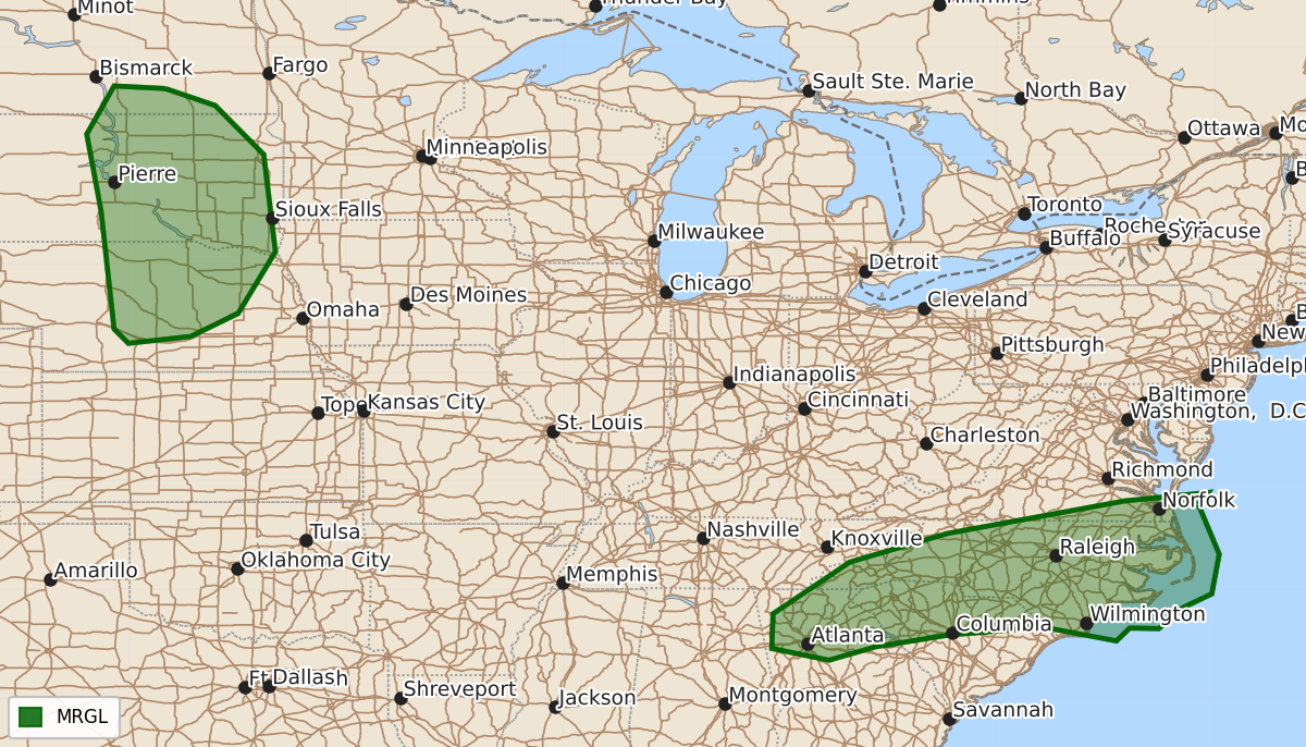
Isolated severe thunderstorms are possible across northern Georgia into the Carolinas and portions of the northern Plains on Friday. These storms may produce damaging winds.
Product Text
000 ACUS03 KWNS 260721 SWODY3 SPC AC 260720 Day 3 Convective Outlook NWS Storm Prediction Center Norman OK 0220 AM CDT Wed Aug 26 2026 Valid 281200Z - 291200Z ...THERE IS A MARGINAL RISK OF SEVERE THUNDERSTORMS ACROSS NORTH GEORGIA INTO THE CAROLINAS AND PORTIONS OF THE NORTHERN PLAINS.... ...SUMMARY... Isolated strong to severe storms are possible across northern Georgia into the Carolinas and the northern Plains. ...Central Plains... The upper-level ridge across the Plains will start to deamplify on Friday. Simultaneously, a lee trough will develop across the northern Plains and into the central High Plains. Strengthening low-level flow will lead to a moistening/destabilizing airmass east of the lee trough. In addition, the low-level jet will strengthen to near 40 knots across the Plains. Increasing isentropic ascent associated with this strengthening low-level jet will be the primary forcing mechanism for storms across the region. 00Z guidance focuses this low-level jet east of the primary instability which creates considerable uncertainty for storm coverage and intensity. Given the environment for severe weather across the region, have highlighted the most favorable area with a 5% severe weather probability. ...North Georgia into the Carolinas... A very moist airmass will be present across the Carolinas on Friday with dewpoints in the 70s. Around 20 to 25 knots of mid-level flow may result in occasional storm organization, but weak lapse rates may limit storm intensity. Nonetheless, numerous storms in a very moist, moderate to strongly unstable environment will support some damaging wind potential. Therefore, a Marginal Risk has been added for this threat. ..Bentley.. 08/26/2026 $$