Mesoscale Discussion 1104
Issued: · Valid: –
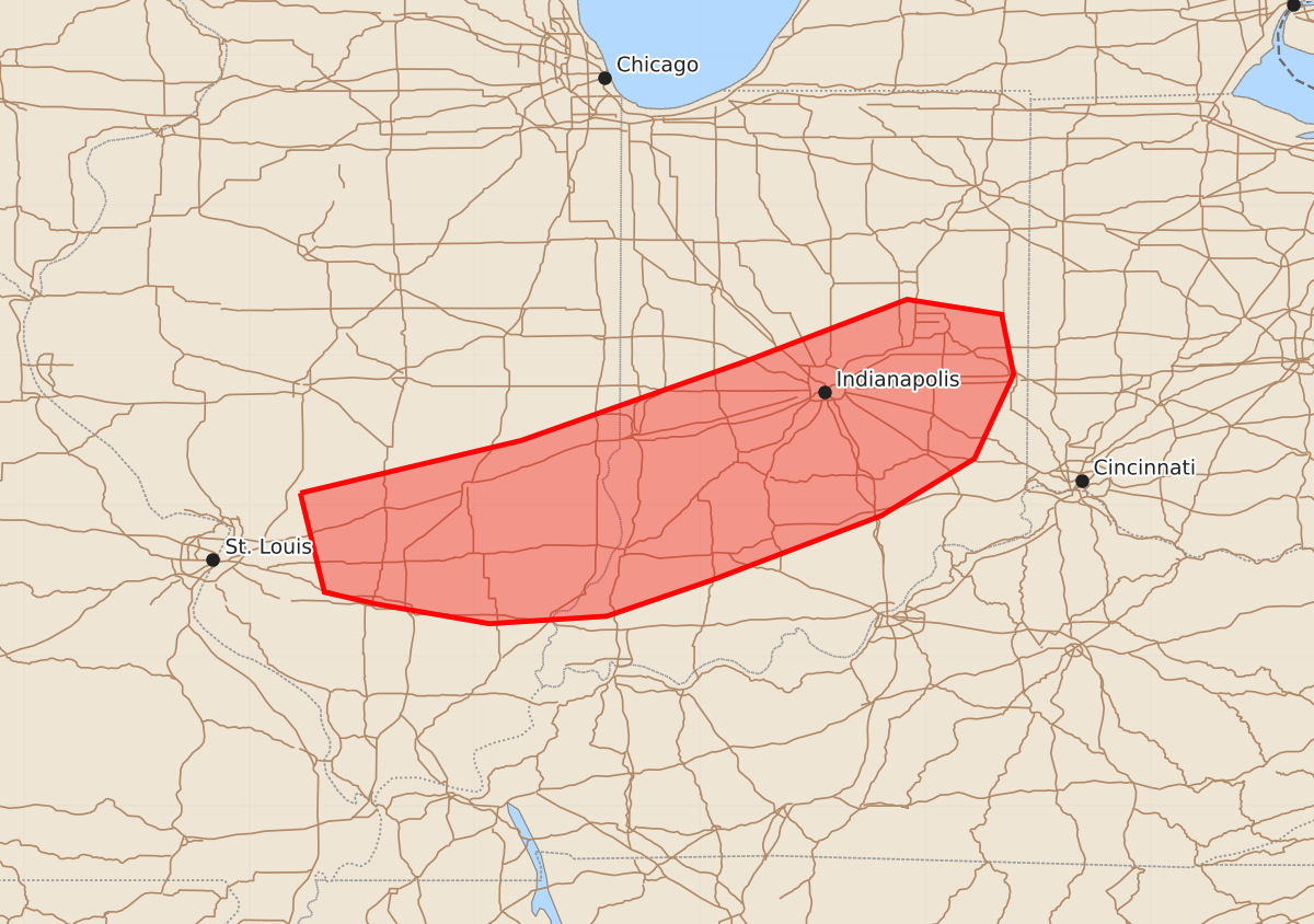
Summary
Severe thunderstorms with damaging winds are expected to move through southern Illinois and parts of southern and central Indiana during the evening. These storms may produce wind gusts between 55 and 70 mph and hail up to 1.25 inches.
Product Text
000 ACUS11 KWNS 120125 SWOMCD SPC MCD 120125 INZ000-ILZ000-120230- Mesoscale Discussion 1104 NWS Storm Prediction Center Norman OK 0825 PM CDT Thu Jun 11 2026 Areas affected...southern Illinois into southern and central Indiana Concerning...Severe potential...Watch needed soon Valid 120125Z - 120230Z Probability of Watch Issuance...95 percent SUMMARY...A severe thunderstorm watch is needed soon from southern Illinois into parts of southern and central Indiana. DISCUSSION...A line of storms continues to move southeast across central Illinois. This line of storms will continue southeast through the evening. While the severe wind threat will likely not be as strong as farther north where the line is more progressive, the strong instability and steep lapse rate environment will support a damaging wind threat with these storms through the evening. A severe thunderstorm watch will be issued soon for this threat. ..Bentley/Smith.. 06/12/2026 ...Please see www.spc.noaa.gov for graphic product... ATTN...WFO...ILN...LMK...IWX...IND...PAH...ILX...LSX... LAT...LON 39088966 39438819 39968669 40378562 40278499 39878491 39318517 38938579 38508692 38268762 38218840 38348915 38428950 39088966 MOST PROBABLE PEAK TORNADO INTENSITY...UP TO 90 MPH MOST PROBABLE PEAK WIND GUST...55-70 MPH MOST PROBABLE PEAK HAIL SIZE...UP TO 1.25 IN