Mesoscale Discussion 2339
Issued: · Valid: –
Summary
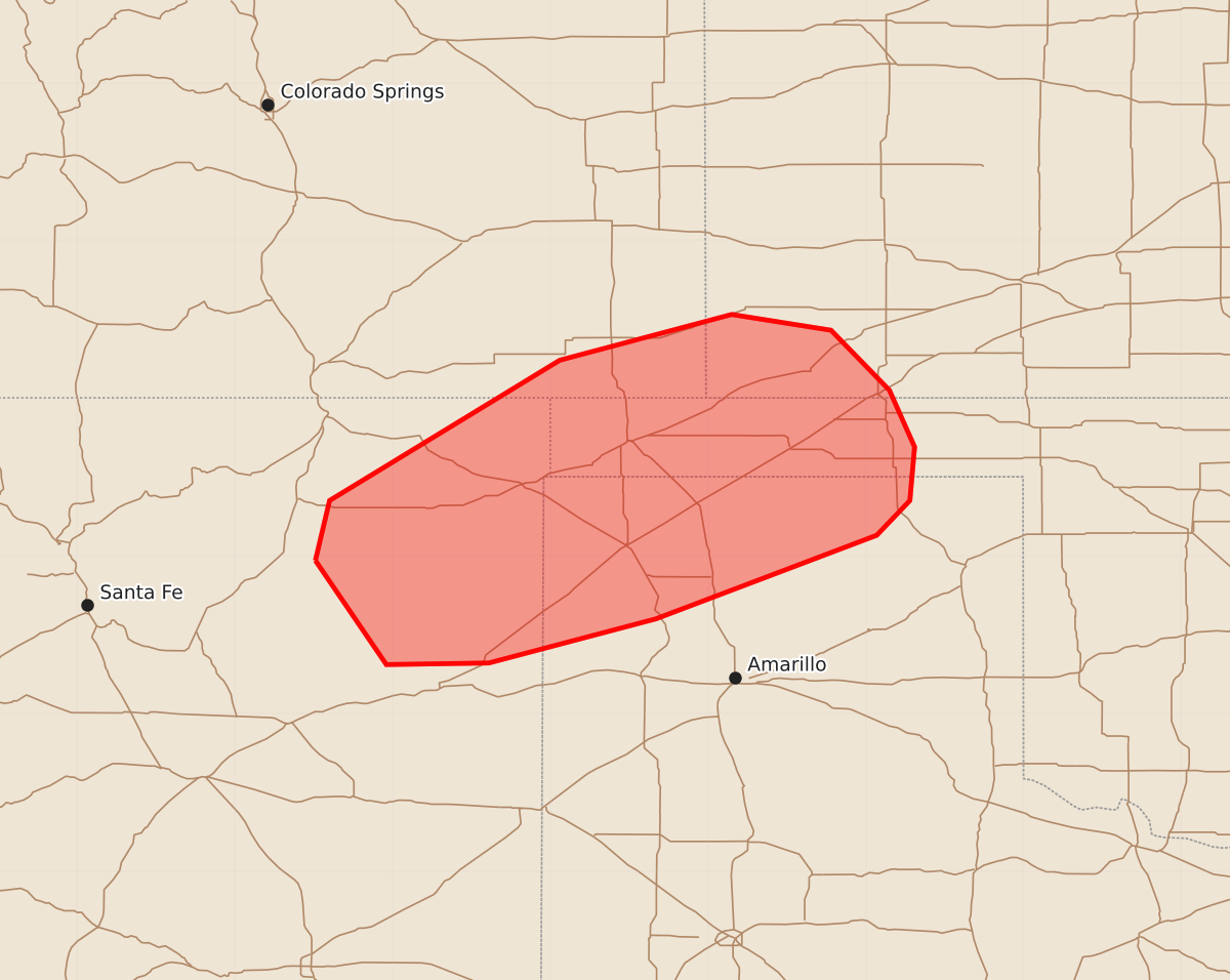
Low topped storms may produce marginally severe hail and strong to severe winds across northeastern New Mexico and the Oklahoma and Texas Panhandles this afternoon and evening.
Product Text
000 ACUS11 KWNS 302101 SWOMCD SPC MCD 302101 COR OKZ000-TXZ000-KSZ000-COZ000-NMZ000-302300- Mesoscale Discussion 2339 NWS Storm Prediction Center Norman OK 0401 PM CDT Wed Sep 30 2026 Areas affected...northeastern New Mexico into the Oklahoma/Texas Panhandles Concerning...Severe potential...Watch unlikely Valid 302101Z - 302300Z CORRECTED FOR SUMMARY TEXT Probability of Watch Issuance...20 percent SUMMARY...A few low topped storms may produce instances of marginally severe hail and strong to severe wind this afternoon/evening. DISCUSSION...Cooling mid-level temperatures and increasing forcing for ascent with the trough behind the surface low across New Mexico is leading to gradual destabilization and increase in thunderstorm activity across northeastern New Mexico. Moisture is somewhat limited to the west across New Mexico, with low to mid 50s dew points, improving with eastward extent into the OK/TX panhandles with around 250-500 J/kg of MLCAPE. This fairly marginal instability will be sufficient, given strong deep layer shear, for a few low-topped storms/transient supercells capable of marginally severe hail and strong to severe wind. This will shift eastward into the panhandles with time this evening. Overall, this potential looks to remain fairly isolated and watch issuance is not anticipated. ..Thornton/Mosier.. 09/30/2026 ...Please see www.spc.noaa.gov for graphic product... ATTN...WFO...DDC...AMA...PUB...ABQ... LAT...LON 35970449 36350440 37240294 37530185 37430122 37050085 36690069 36350072 36130093 35600233 35320339 35310404 35970449 MOST PROBABLE PEAK TORNADO INTENSITY...UP TO 90 MPH MOST PROBABLE PEAK WIND GUST...UP TO 60 MPH MOST PROBABLE PEAK HAIL SIZE...UP TO 1.25 IN