Mesoscale Discussion 1241
Issued: · Valid: –
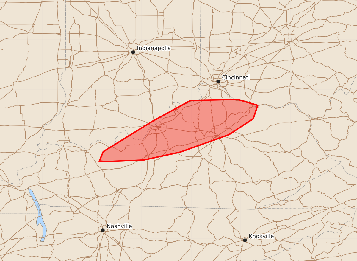
Summary
A tornado threat is likely to develop across portions of northern Kentucky later this evening as supercells move into the region. These storms may produce significant tornadoes, wind gusts up to 80 mph, and hail up to 1.25 inches.
Product Text
000 ACUS11 KWNS 220103 SWOMCD SPC MCD 220102 OHZ000-KYZ000-INZ000-220200- Mesoscale Discussion 1241 NWS Storm Prediction Center Norman OK 0802 PM CDT Sun Jun 21 2026 Areas affected...portions of northern Kentucky Concerning...Severe potential...Watch needed soon Valid 220102Z - 220200Z Probability of Watch Issuance...95 percent SUMMARY...A new tornado watch likely will be needed across portions of northern Kentucky. DISCUSSION...A tornado threat is likely to develop later this evening as a broken line of supercells moves into the region. These supercells have a history of confirmed tornadoes. The overall environment across northern Kentucky is marginally to moderately unstable, with MUCAPE ranging from just under 1000 J/kg to around 1500 J/kg. Continued low-level theta-e advection to the southeast of a MCV across central Indiana should sustain or slightly increase instability despite the loss of diurnal heating. Additionally, a favorable kinematic environment (Louisville VAD showing 0-3 kilometer SRH increasing the last hour to nearly 500 m2/s2) will remain into the late evening hours. Thus, as the upstream supercells move into the region, the threat for tornadoes will persist. A new tornado watch will likely be needed within the hour. ..Marsh/Smith.. 06/22/2026 ...Please see www.spc.noaa.gov for graphic product... ATTN...WFO...JKL...ILN...LMK... LAT...LON 37758677 38368578 38788501 38808406 38688366 38418375 38098424 37748522 37588596 37558670 37568685 37758677 MOST PROBABLE PEAK TORNADO INTENSITY...100-125 MPH MOST PROBABLE PEAK WIND GUST...65-80 MPH MOST PROBABLE PEAK HAIL SIZE...UP TO 1.25 IN