Mesoscale Discussion 1106
Issued: · Valid: –
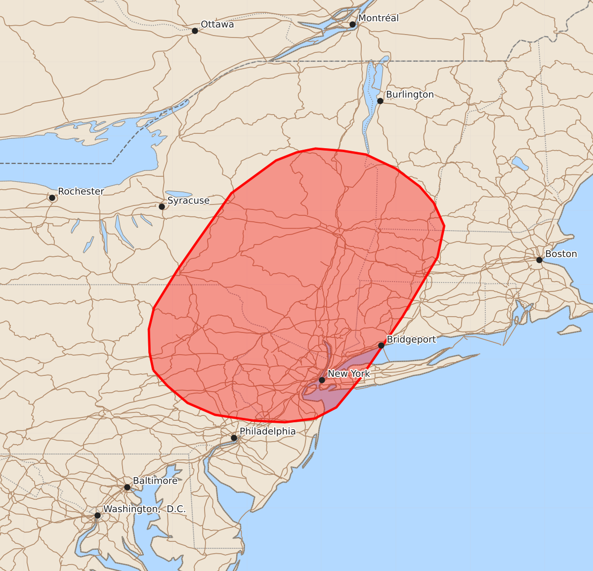
Summary
Widely scattered thunderstorms with the potential for damaging wind gusts are expected across portions of the Mid-Atlantic and Northeast this afternoon and evening. The risk of wind gusts up to 60 mph is highest in southeastern New York and adjacent areas.
Product Text
000 ACUS11 KWNS 121749 SWOMCD SPC MCD 121748 NYZ000-NHZ000-MAZ000-VTZ000-CTZ000-NJZ000-PAZ000-121945- Mesoscale Discussion 1106 NWS Storm Prediction Center Norman OK 1248 PM CDT Fri Jun 12 2026 Areas affected...portions of the Mid-Atlantic and Northeast Concerning...Severe potential...Watch possible Valid 121748Z - 121945Z Probability of Watch Issuance...40 percent SUMMARY...Widely scattered thunderstorms and a risk of occasional damaging wind gusts are expected across portions of the Mid-Atlantic and Northeast this afternoon/evening. DISCUSSION...Latest regional radar imagery depicts ongoing thunderstorm development across portions of the Mid-Atlantic and Northeast along a surface cold front and prefrontal trough. This activity is occurring as weak mid-level height falls begin to overspread the region ahead of a mid-level shortwave trough progressing across the Great Lakes region. While mid-level lapse rates will remain weak, strong surface heating and dewpoints around 70 F will support 1000 to locally 2000+ J/kg MLCAPE by peak heating this afternoon as convection evolves eastward. While stronger deep-layer flow will remain displaced to the north, modest mid-level westerlies of 25-35 kts and steepening low-level lapse rates will promote the potential for multicell clusters capable of occasional damaging wind gusts. Currently, the greatest potential appears likely to manifest across southeastern New York and adjacent areas where the best overlap of modestly stronger mid-level flow and greater buoyancy may develop. A Severe Thunderstorm Watch may be needed for portions of the discussion area within the next 1-2 hours to cover these threats. More uncertainty exists regarding watch issuance farther south into southeastern Pennsylvania and southern New Jersey where latest guidance indicates a relative minimum in convective coverage could occur. ..Chalmers/Thompson.. 06/12/2026 ...Please see www.spc.noaa.gov for graphic product... ATTN...WFO...GYX...BOX...BTV...OKX...ALY...PHI...BGM...CTP... LAT...LON 40857626 41097631 41407632 41697625 42197594 42587567 43237521 43677461 43787433 43837408 43807371 43757340 43567300 43327268 43107249 42797235 42377244 41577291 40757347 40357380 40207409 40157449 40177490 40257543 40417580 40647607 40857626 MOST PROBABLE PEAK WIND GUST...UP TO 60 MPH