Mesoscale Discussion 1478
Issued: · Valid: –
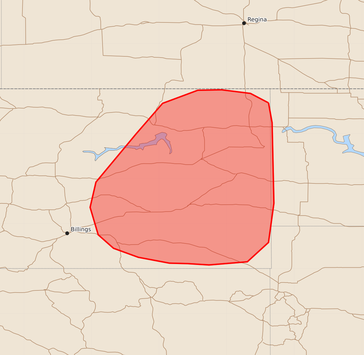
Summary
Isolated severe wind gusts and hail are possible across parts of eastern Montana this evening. The expected severity of these storms is marginal.
Product Text
000 ACUS11 KWNS 032256 SWOMCD SPC MCD 032255 NDZ000-SDZ000-MTZ000-040100- Mesoscale Discussion 1478 NWS Storm Prediction Center Norman OK 0555 PM CDT Fri Jul 03 2026 Areas affected...Eastern Montana Concerning...Severe potential...Watch unlikely Valid 032255Z - 040100Z Probability of Watch Issuance...20 percent SUMMARY...Isolated severe wind gusts and hail will be possible this evening across parts of eastern Montana. The threat is expected to be marginal, and additional weather watch issuance appears unlikely. DISCUSSION...Latest surface analysis shows a surface trough over eastern Montana, along which low-level convergence is maximized. Near the convergence axis, surface dewpoints are in the upper 50s F and MLCAPE is estimated by the RAP in the 1000 to 1500 J/kg range. A broken line of strong thunderstorms is ongoing along the western edge of the stronger instability, and appears to be supported by a mid-level shortwave trough approaching from the west. The Glasgow and Billings WSR-88D VWPs have 25 to 30 knots of deep-layer shear. In addition, RAP forecast soundings show steep low to mid-level lapse rates. This environment could be enough for an isolated severe threat with strong wind gusts and hail possible. ..Broyles/Gleason.. 07/03/2026 ...Please see www.spc.noaa.gov for graphic product... ATTN...WFO...BIS...UNR...BYZ...GGW... LAT...LON 48680407 48890447 48970511 48960564 48670642 47990701 46920790 46360803 45750785 45450751 45250696 45120627 45110587 45080539 45150454 45580407 46450395 48240399 48680407 MOST PROBABLE PEAK WIND GUST...UP TO 60 MPH MOST PROBABLE PEAK HAIL SIZE...1.00-1.75 IN