Mesoscale Discussion 1142
Issued: · Valid: –
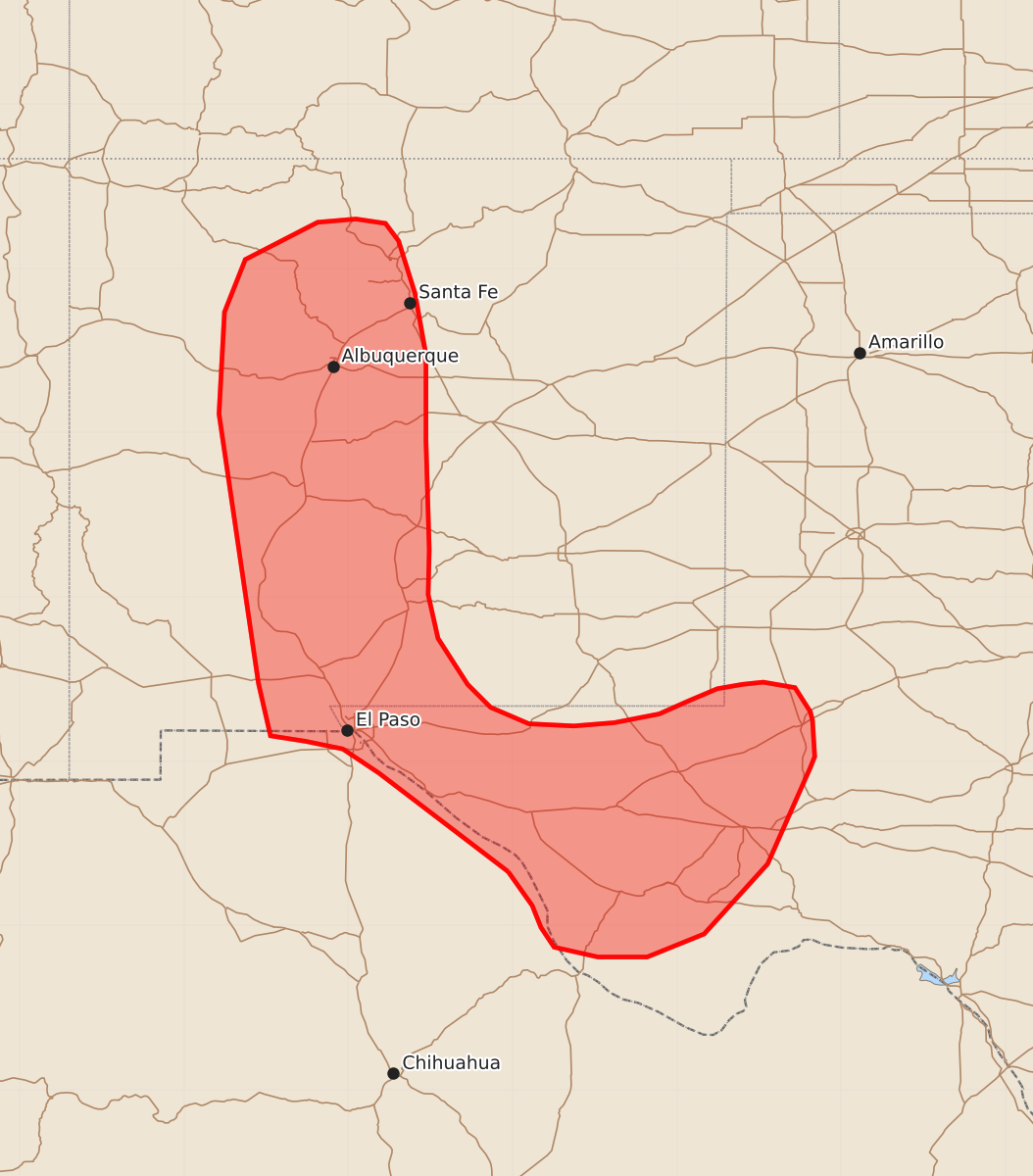
Summary
Isolated to widely scattered thunderstorms will bring a risk of damaging wind gusts and large hail to portions of New Mexico and West Texas through this evening.
Product Text
000 ACUS11 KWNS 142020 SWOMCD SPC MCD 142019 TXZ000-NMZ000-142215- Mesoscale Discussion 1142 NWS Storm Prediction Center Norman OK 0319 PM CDT Sun Jun 14 2026 Areas affected...portions of New Mexico and West Texas Concerning...Severe potential...Watch unlikely Valid 142019Z - 142215Z Probability of Watch Issuance...20 percent SUMMARY...Isolated to widely scattered thunderstorms will pose a risk for isolated damaging wind gusts and large hail through this evening. Watch issuance is unlikely. DISCUSSION...Latest visible satellite and regional radar imagery depict developing thunderstorms along higher terrain areas from western New Mexico into West Texas, with additional thunderstorms ongoing along a cold front west of Midland. In central New Mexico, dewpoints near 50 F and continued insolation are yielding weak buoyancy (500-1000 J/kg MLCAPE per the 18z ABQ sounding), with modified 18z EPZ/ABQ soundings suggesting lingering inhibition is eroding. As convection spreads eastward off of the high terrain, well-mixed boundary layer profiles (LCLs close to 3 km) and steep low-level lapse rates will support evaporatively-cooled downdrafts capable of isolated damaging wind gusts. Modestly strong upper-level flow associated with the subtropical jet stream is also supporting of 30-35+ kts, which will support some potential for isolated large hail when coupled with modestly steep mid-level lapse rates of around 7.5 C/km. Greater instability exists with southward extent into West Texas, with dewpoints increasing into the low-60s F ahead of a surface cold front. This is yielding a better overlap of buoyancy and shear across the southern portions of the discussion area, which may favor a marginally greater severe risk compared to areas farther north. Watch issuance appears unlikely at this time owing to the overall expectation for the severe risk to remain limited in coverage/magnitude. ..Chalmers/Mosier.. 06/14/2026 ...Please see www.spc.noaa.gov for graphic product... ATTN...WFO...MAF...ABQ...EPZ... LAT...LON 30490504 31390622 31610655 31680689 31730721 32210732 34670768 35600763 36080744 36420678 36450643 36410616 36250604 35770589 35210579 34430579 33430576 33020577 32620568 32200541 31990520 31840485 31820444 31850407 31930366 32050339 32160313 32200290 32220271 32170242 31950228 31870226 31540224 31440228 30560267 29920325 29710377 29710422 29800462 29980474 30180482 30490504 MOST PROBABLE PEAK WIND GUST...55-70 MPH MOST PROBABLE PEAK HAIL SIZE...1.00-1.75 IN