Mesoscale Discussion 1096
Issued: · Valid: –
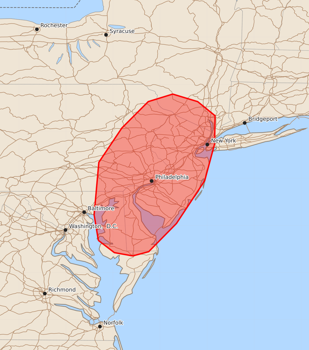
Summary
Thunderstorms capable of producing damaging wind gusts between 50 and 70 mph will move eastward across parts of the northern Mid-Atlantic region through this evening.
Product Text
000 ACUS11 KWNS 112210 SWOMCD SPC MCD 112209 NYZ000-NJZ000-PAZ000-MDZ000-DEZ000-120045- Mesoscale Discussion 1096 NWS Storm Prediction Center Norman OK 0509 PM CDT Thu Jun 11 2026 Areas affected...Parts of the northern Mid-Atlantic region Concerning...Severe potential...Watch likely Valid 112209Z - 120045Z Probability of Watch Issuance...80 percent SUMMARY...Thunderstorms capable of producing damaging winds (50-65 mph) will spread eastward over the next few hours. A watch will likely be issued in the next hour or so. DISCUSSION...A north/south-oriented broken band of thunderstorms is tracking eastward across central PA, southern NY, and eastern WV at around 30-35 kt. These storms have a history of producing scattered damaging wind gusts and measured gusts upwards of 45 mph. As a low-amplitude shortwave trough continues eastward across western/central PA/NY, this band of storms should progress eastward into eastern PA and vicinity by around 01Z. The downstream air mass is characterized by lower 90s temperatures amid lower 70s dewpoints and steep low-level lapse rates. This environment will remain favorable for damaging wind gusts (50-65 mph) into this evening, especially given the established line of storms and 35-kt unidirectional flow in the lowest 1 km (sampled by the CCX VWP). A watch will likely be issued for parts of the area in the next hour or so. ..Weinman/Smith.. 06/11/2026 ...Please see www.spc.noaa.gov for graphic product... ATTN...WFO...OKX...ALY...PHI...BGM...AKQ...CTP...LWX... LAT...LON 38687631 39227640 40347630 41077581 41637525 41797473 41637420 41337383 40737384 39957405 39047465 38447524 38357558 38357558 38427597 38687631 MOST PROBABLE PEAK WIND GUST...55-70 MPH MOST PROBABLE PEAK HAIL SIZE...UP TO 1.25 IN