Mesoscale Discussion 1380
Issued: · Valid: –
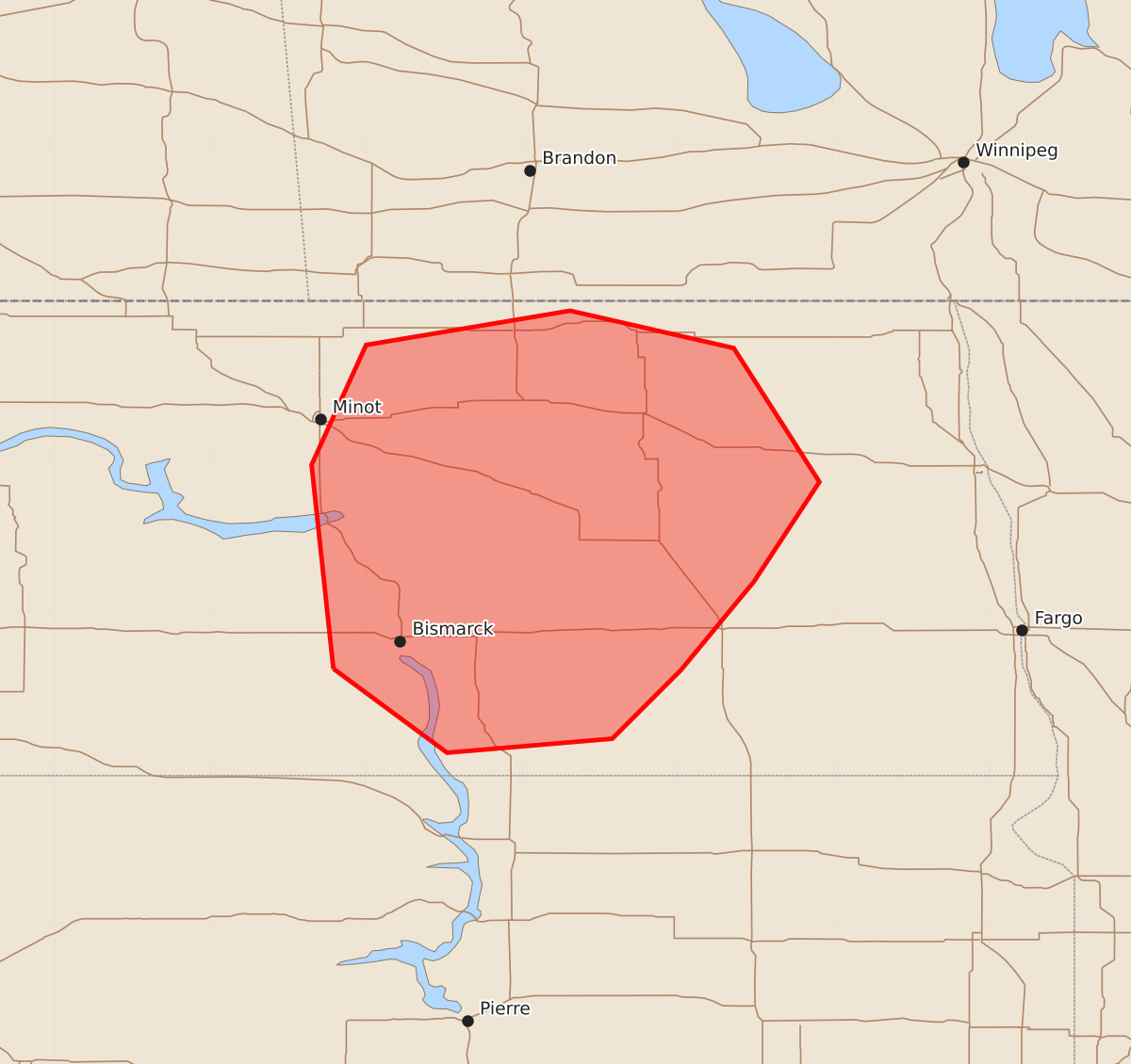
Summary
Severe thunderstorms capable of large hail, tornadoes, and damaging winds are expected to develop across central North Dakota by late afternoon. The potential for these severe hazards increases between 1:41 PM and 2:45 PM CDT.
Product Text
000 ACUS11 KWNS 291742 SWOMCD SPC MCD 291741 NDZ000-291945- Mesoscale Discussion 1380 NWS Storm Prediction Center Norman OK 1241 PM CDT Mon Jun 29 2026 Areas affected...Central North Dakota Concerning...Severe potential...Watch likely Valid 291741Z - 291945Z Probability of Watch Issuance...80 percent SUMMARY...The potential for severe thunderstorms capable of all hazards is expected to increase by 19-20Z. A watch is likely. DISCUSSION...Recent trends in visible satellite and radar data indicate a gradual increase in shower and thunderstorm development across western ND into northwest SD. That activity is located to the west of a n-s-oriented stationary front/inverted trough located over central ND and within a zone of increased forcing for ascent preceding a short-wave trough and associated mid-level jet streak pivoting through eastern WY. To the east of the front, dewpoints in the 70s and a gradually warming boundary layer are contributing to a moderately unstable and increasingly uncapped air mass with MLCAPE of 1000-2000+ J/kg, per latest objective analysis. The current expectation is for surface-based storm development to occur in the vicinity of the front/trough by 19-20Z within a kinematic environment featuring low-level easterly winds veering to southerly in the mid/upper levels with 50-60 kt of effective bulk shear. As such, the potential will exist for initial supercell storm modes with an associated risk for large to very large hail and perhaps a few tornadoes. There is some signal in recent CAM guidance that initial storms could evolve into bowing segments, which would be supportive of an increased damaging wind threat. ..Mead/Guyer.. 06/29/2026 ...Please see www.spc.noaa.gov for graphic product... ATTN...WFO...FGF...BIS... LAT...LON 46630121 47940135 48710100 48939969 48699864 47839809 47199851 46629898 46189942 46090048 46630121 MOST PROBABLE PEAK TORNADO INTENSITY...100-125 MPH MOST PROBABLE PEAK WIND GUST...55-70 MPH MOST PROBABLE PEAK HAIL SIZE...1.50-2.50 IN