Day 3 Convective Outlook
Issued: · Valid: –
Summary
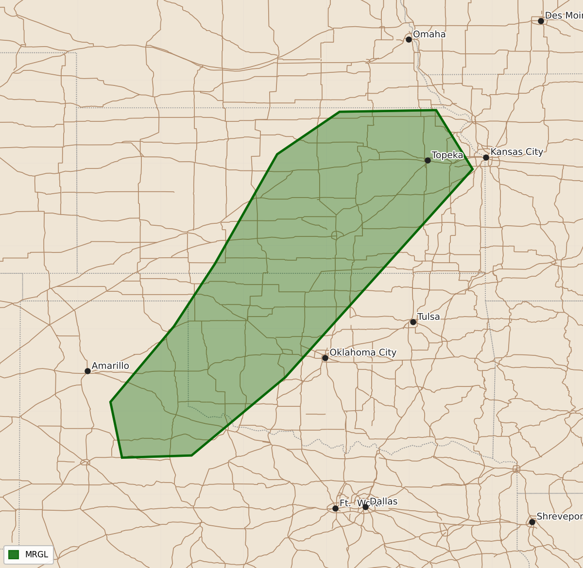
Isolated severe thunderstorms bringing hail and damaging winds are possible across portions of the southeastern Texas Panhandle, western Oklahoma, and central Kansas this Saturday.
Product Text
000 ACUS03 KWNS 241913 SWODY3 SPC AC 241912 Day 3 Convective Outlook NWS Storm Prediction Center Norman OK 0212 PM CDT Thu Sep 24 2026 Valid 261200Z - 271200Z ...THERE IS A MARGINAL RISK OF SEVERE THUNDERSTORMS FROM PORTIONS OF THE SOUTHEASTERN TEXAS PANHANDLE...ACROSS WESTERN OKLAHOMA AND INTO CENTRAL KANSAS... ...SUMMARY... Isolated hail and damaging winds may accompany a few strong to severe thunderstorms across portions of the central and southern Plains Saturday. ...Synopsis... An upper low over the eastern US will remain in place as mid-level flow trends more zonal this weekend. Shortwave ridging over the western US should temporarily intensify ahead of a series of low-amplitude Pacific troughs approaching the coast. A subtle shortwave perturbation will move from the Rockies and across the central US with mid-level flow gradually turning northwesterly in its wake. Surface lee troughing and a weak cyclone should deepen over the central and southern High Plains amidst a moist monsoon/tropical air mass. Scattered thunderstorms with at least isolated severe potential are expected. ...Central and southern Plains... Ahead of the weak low and lee trough, southerly low-level flow will aid in maintaining a moist air mass across much of TX/OK and KS. Diurnal heating and subtle surface confluence ahead of the trough should allow for weak to moderate destabilization through the afternoon. Two areas of thunderstorm initiation appear possible, along and ahead of the surface low in KS where mid-level flow is stronger (deep-layer shear of 30+ kt), and farther southwest along the lee trough into western OK and the east/southeastern TX Panhandle. Lingering clouds and showers in eastern KS cast some uncertainty on destabilization and the presence of surface-based storms farther north. Still, isolated hail would be possible with any storms near the surface low. Despite somewhat weak flow aloft farther southwest, veering with height should yield 20-30 kts of effective bulk shear with modestly curved and elongated hodographs. Peak afternoon buoyancy of 1500-2000 J/kg along and east of the lee trough with temperatures in the 80s and upper 50s to low 60s F dewpoints will be capable of supporting strong updrafts. As such, a few organized multicells and transient supercells may develop and intensify along a narrow corridor through the afternoon. Modestly steep mid-level lapse rates and sufficient buoyancy may support an isolated severe wind/hail threat with the stronger/organized storms. ..Lyons.. 09/24/2026 $$