Mesoscale Discussion 1540
Issued: · Valid: –
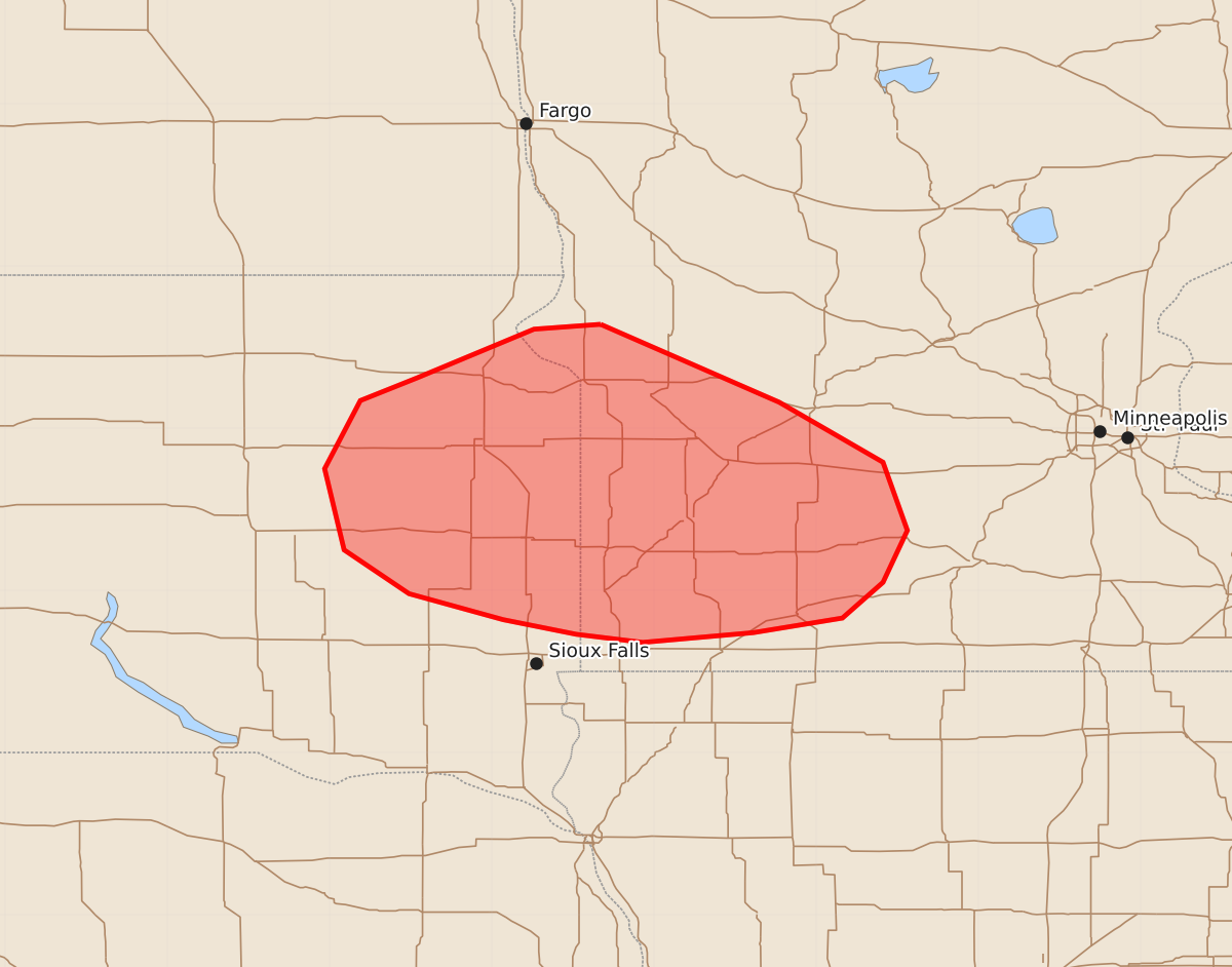
Summary
Occasional strong to severe wind gusts are possible through the morning across eastern South Dakota into western Minnesota.
Product Text
000 ACUS11 KWNS 080558 SWOMCD SPC MCD 080558 MNZ000-SDZ000-080700- Mesoscale Discussion 1540 NWS Storm Prediction Center Norman OK 1258 AM CDT Wed Jul 08 2026 Areas affected...eastern South Dakota into western Minnesota Concerning...Severe potential...Watch unlikely Valid 080558Z - 080700Z Probability of Watch Issuance...20 percent SUMMARY...Occasional strong to severe gusts will be possible through the morning across eastern SD into western MN. DISCUSSION...A line of thunderstorms is ongoing along arcing outflow across eastern SD. This will soon cross the surface boundary that extends across eastern SD into western MN. Recent gusts 60-63 mph were reported across eastern SD. The environment north and south of the boundary remains favorably sheared and unstable, with around 1000-2000 J/kg of MLCAPE an 30-40 kts of deep layer shear. Inhibition is strong along and south of the boundary, likely meaning that storms are elevated in nature which may limit the overall severe potential. A few strong to severe gusts may be possible through the morning. A watch is unlikely to be needed but trends will be monitored. ..Thornton/Mosier.. 07/08/2026 ...Please see www.spc.noaa.gov for graphic product... ATTN...WFO...MPX...FSD...ABR... LAT...LON 45649633 45619674 45319746 45179781 44759803 44259791 43989751 43829693 43739648 43689607 43749539 43839484 44059459 44379444 44799459 45169523 45649633 MOST PROBABLE PEAK TORNADO INTENSITY...UP TO 90 MPH MOST PROBABLE PEAK WIND GUST...55-70 MPH MOST PROBABLE PEAK HAIL SIZE...UP TO 1.25 IN