Mesoscale Discussion 1874
Issued: · Valid: –
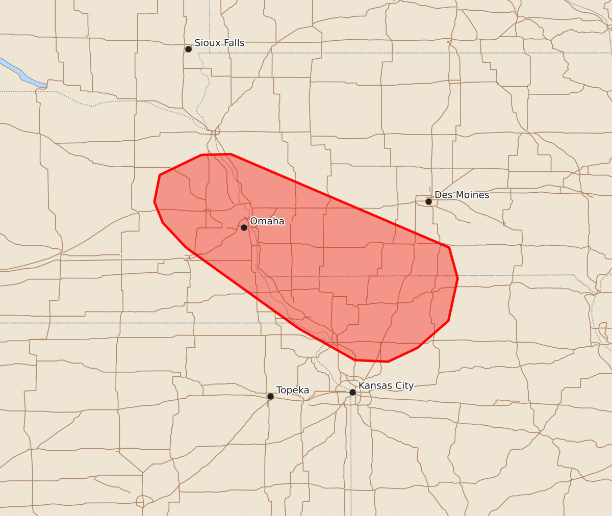
Summary
Isolated severe thunderstorms capable of producing large hail and strong wind gusts may occur overnight across eastern Nebraska, southwest Iowa, and northern Missouri. These storms are expected to be sporadic through the early morning hours.
Product Text
000 ACUS11 KWNS 090418 SWOMCD SPC MCD 090418 MOZ000-IAZ000-KSZ000-NEZ000-090615- Mesoscale Discussion 1874 NWS Storm Prediction Center Norman OK 1118 PM CDT Sat Aug 08 2026 Areas affected...Eastern Nebraska into southwest Iowa and northern Missouri Concerning...Severe potential...Watch unlikely Valid 090418Z - 090615Z Probability of Watch Issuance...20 percent SUMMARY...Elevated thunderstorms may pose a risk of isolated large hail and severe gusts through the overnight hours for parts of far eastern Nebraska into southwest Iowa and northern/northwest Missouri. The severe risk is expected to generally remain sufficiently isolated to preclude the need for a watch. DISCUSSION...Convection has been percolating across southwest IA over the past hour, and is largely being driven by modest isentropic ascent between 925-850 mb on the eastern fringe of a low-level thermal ridge where capping is weaker. Although this activity is displaced to the east of greater instability over NE/KS, latest mesoanalysis estimates and the 00 UTC OAX RAOB show MUCAPE values of 2000-3000 J/kg from eastern NE into northern MO. Additionally, mid-level winds on the order of 50 knots are supporting effective bulk shear values of similar magnitude oriented along the buoyancy gradient. This thermodynamic and kinematic environment is conducive for organized severe convection, and recent radar trends appear to reflect this - a few deeper cores within the cluster have exhibited vertical ice signatures consistent with severe hail. The expectation over the next several hours is for additional thunderstorm development across southwest IA into adjacent portions of north/northwest MO with additional re-development probable across far eastern NE based on latest GOES IR trends. Storm motions along the zone of initiation will promote destructive storm interactions that will likely limit the overall propensity for long-lived/intense convection. However, given the ambient environment a few strong/severe thunderstorms appear likely through the early morning hours - mainly posing a threat for large hail and perhaps severe gusts. Recent RRFS solutions appear to be capturing this overall signal well (even if a little delayed) and suggest the overall severe threat should be isolated in nature, but could persist to around 12 UTC. ..Moore/Mosier.. 08/09/2026 ...Please see www.spc.noaa.gov for graphic product... ATTN...WFO...DMX...EAX...OAX...TOP... LAT...LON 42189656 42199618 40989335 40589324 40039336 39689376 39509414 39529457 39939530 40989676 41309706 41579717 41929710 42189656 MOST PROBABLE PEAK WIND GUST...55-70 MPH MOST PROBABLE PEAK HAIL SIZE...1.00-1.75 IN