Mesoscale Discussion 1731
Issued: · Valid: –
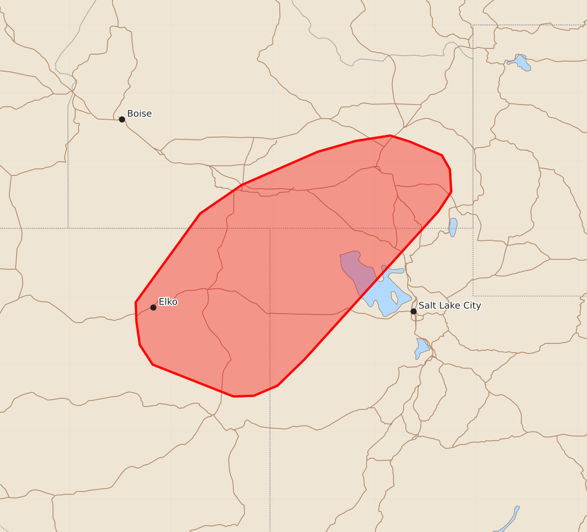
Summary
Scattered thunderstorms capable of producing isolated severe wind gusts between 55 and 70 mph are expected across northeast Nevada, northwest Utah, and southeast Idaho through early evening.
Product Text
000 ACUS11 KWNS 252053 SWOMCD SPC MCD 252052 IDZ000-UTZ000-NVZ000-252245- Mesoscale Discussion 1731 NWS Storm Prediction Center Norman OK 0352 PM CDT Sat Jul 25 2026 Areas affected...Northeast Nevada into northwest Utah and southeast Idaho Concerning...Severe potential...Watch unlikely Valid 252052Z - 252245Z Probability of Watch Issuance...20 percent SUMMARY...Scattered thunderstorm development is expected within the next couple of hours across northeast Nevada, northwest Utah, and southeast Idaho. The primary risk will be severe wind gusts associated with intense downbursts; however, this threat should be sufficiently isolated to preclude watch issuance. DISCUSSION...Building cumulus and occasional lightning flashes are noted across northeast NV into far west/northwest UT as temperatures warm into the low to mid 90s and diurnal orographic ascent continues to increase. Based on recent 18 UTC LKN and SLC RAOBs, any lingering inhibition should be eroded as temperatures exceed 95 F, which should support sustained deep convection in the coming hours. Favorable low-level moisture (dewpoints in the low 50s) is supporting MLCAPE values on the order of 500-1000 J/kg, which should be sufficient for a few more intense updrafts. Observed dewpoint depressions on the order of 40-45 F also hint that boundary-layer depth is increasing to around 2 km, which should favor downdraft accelerations near the ground, especially with the stronger updrafts/heavier precipitation cores. Latest high-res guidance hints that peak downburst wind gusts on the order of 55-70 mph will be possible as thunderstorm coverage gradually increases through early evening, however, fairly modest deep-layer wind shear should promote poorly organized, outflow-dominant convection with limited longevity and only sporadic coverage of severe winds. ..Moore/Smith.. 07/25/2026 ...Please see www.spc.noaa.gov for graphic product... ATTN...WFO...SLC...PIH...BOI...LKN... LAT...LON 39521458 39991577 40281596 40631601 40911602 42221507 42641446 43131334 43291278 43371227 43281198 43081151 42871139 42541137 42251156 40071353 39681393 39531428 39521458 MOST PROBABLE PEAK WIND GUST...55-70 MPH