Mesoscale Discussion 2324
Issued: · Valid: –
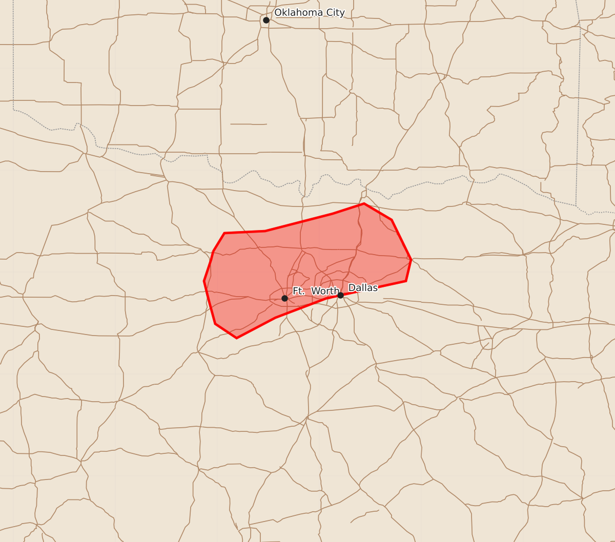
Summary
Strong wind gusts of up to 60 mph may affect parts of the Dallas-Fort Worth Metroplex later this evening. These gusts could result in isolated instances of damaging winds.
Product Text
000 ACUS11 KWNS 212236 SWOMCD SPC MCD 212236 TXZ000-220100- Mesoscale Discussion 2324 NWS Storm Prediction Center Norman OK 0536 PM CDT Mon Sep 21 2026 Areas affected...parts of North Texas Concerning...Severe potential...Watch unlikely Valid 212236Z - 220100Z Probability of Watch Issuance...5 percent SUMMARY...Strong wind gusts may affect parts of the Metroplex later this evening. Isolated damaging gusts cannot be ruled out. DISCUSSION...A cluster of storms that formed in southern OK continues to push south/southeast across the Red River, with the stronger storm moving through Gainesville TX. Other cells are also developing along the outflow, extending into northern Wise and Jack counties. Meanwhile, an older outflow boundary is pushing north and extends from Dallas to Hood counties. This area has become relatively hot today, with upper 90s to near 100 F temperatures. Surface analysis also indicates a low between the storms to the north and northward-moving outflow to the south. Given the steep low level lapse rates ahead of these storms (which are substantial in height), and possibility of increased surface convergence/colliding outflows, it seems possible at least strong outflow will affect the Metroplex later this evening, with perhaps locally damaging gusts assuming storm cores continue to develop as they approach out of the north. ..Jewell/Guyer.. 09/21/2026 ...Please see www.spc.noaa.gov for graphic product... ATTN...WFO...FWD... LAT...LON 33209804 33389793 33409753 33579687 33679656 33519629 33129610 32919615 32749693 32559743 32359781 32499802 32719808 32919813 33129806 33209804 MOST PROBABLE PEAK WIND GUST...UP TO 60 MPH MOST PROBABLE PEAK HAIL SIZE...UP TO 1.25 IN