Mesoscale Discussion 1364
Issued: · Valid: –
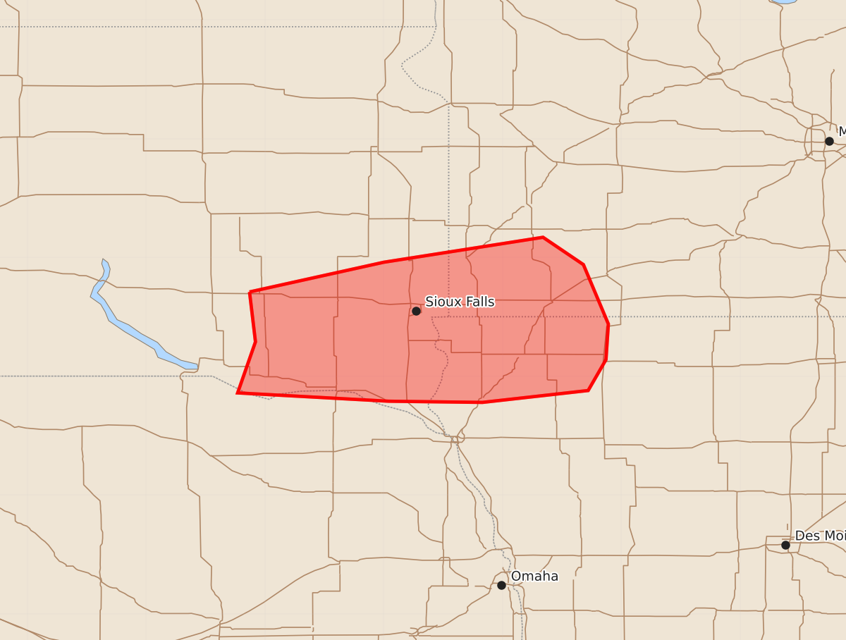
Summary
Damaging winds and large hail are expected across southeast South Dakota, southwest Minnesota, and northwest Iowa through early morning hours on Sunday. Severe thunderstorms capable of producing 55-70 mph wind gusts and 1.25-inch hail may persist through approximately 3:30 AM CDT.
Product Text
000 ACUS11 KWNS 280738 SWOMCD SPC MCD 280737 MNZ000-IAZ000-SDZ000-NEZ000-280930- Mesoscale Discussion 1364 NWS Storm Prediction Center Norman OK 0237 AM CDT Sun Jun 28 2026 Areas affected...southeast South Dakota...southwest Minnesota...northwest Iowa Concerning...Severe Thunderstorm Watch 410... Valid 280737Z - 280930Z The severe weather threat for Severe Thunderstorm Watch 410 continues. SUMMARY...A corridor of damaging winds may persist across southeast South Dakota, with threat possibly extending into southwest Minnesota and northwest Iowa. DISCUSSION...Several severe cells currently exist near and just north of the SD/NE border, and continue to move east. Earlier, several gusts near 60 kt were reported, though more recent measurements indicate somewhat lesser peak gusts closer to 50 kt into the Wagner area. A moist air mass remains ahead of this storm complex, driven by strong warm advection with a 40-50 kt low-level jet. This should support strong to severe storms at least across SD, and perhaps into MN and IA an elevated influx of unstable air continues. Trends will continue to be monitored for an additional watch. ..Jewell.. 06/28/2026 ...Please see www.spc.noaa.gov for graphic product... ATTN...WFO...FSD...OAX... LAT...LON 43719813 43969700 44179566 43949532 43449511 43149513 42889528 42789617 42799696 42869823 43299808 43719813 MOST PROBABLE PEAK WIND GUST...55-70 MPH MOST PROBABLE PEAK HAIL SIZE...UP TO 1.25 IN