Mesoscale Discussion 1149
Issued: · Valid: –
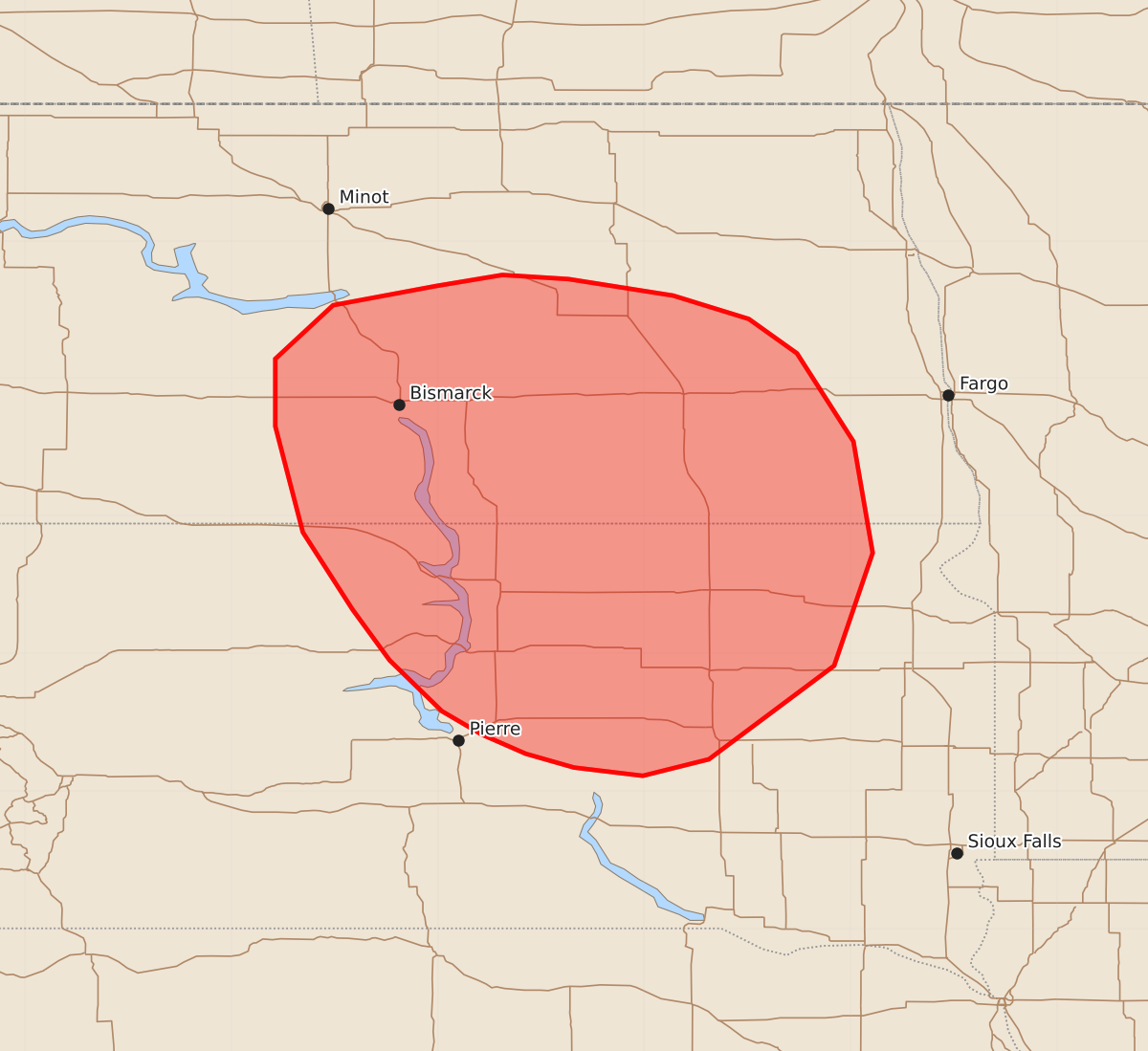
Summary
Isolated to widely scattered thunderstorms may produce strong, isolated severe wind gusts across portions of the northern Great Plains through this afternoon.
Product Text
000 ACUS11 KWNS 151746 SWOMCD SPC MCD 151746 NDZ000-SDZ000-151945- Mesoscale Discussion 1149 NWS Storm Prediction Center Norman OK 1246 PM CDT Mon Jun 15 2026 Areas affected...portions of the northern Great Plains Concerning...Severe potential...Watch unlikely Valid 151746Z - 151945Z Probability of Watch Issuance...20 percent SUMMARY...The potential for strong to isolated severe wind gusts will increase through the afternoon as isolated to widely scattered high-based thunderstorms develop across portions of the northern Great Plains. DISCUSSION...Latest GOES water vapor imagery depicts a shortwave trough moving out of Saskatchewan into northwestern North Dakota. Downstream of this feature, warming surface temperatures ahead of a surface cold front and cold mid-level temperatures are contributing to weak destabilization (on the order of a couple hundred J/kg MLCAPE) as of 1730 UTC. Latest objective analysis also suggests that inhibition is quickly eroding, which is corroborated by recent lightning activity along the ND/SD border. As surface heating results in further destabilization through the afternoon (with 500-700 J/kg MLCAPE likely by peak heating), high-based thunderstorm coverage is expected to increase. While the thermodynamic environment will remain marginal at best, LCLs around 2.5 km will support downward transport of increasing west-northwesterly low-to-mid level flow attendant to the shortwave trough (30+ kts sampled at 1 km AGL by the BIS VAD profile). This will promote an increasing risk for strong to isolated severe wind gusts through this afternoon. Watch issuance is unlikely at this time owing to the limited magnitude and isolated coverage of the severe threat. ..Chalmers/Mosier.. 06/15/2026 ...Please see www.spc.noaa.gov for graphic product... ATTN...WFO...FGF...FSD...ABR...BIS... LAT...LON 47670051 47750003 47729955 47609879 47439824 47189789 46549748 45739734 44919762 44239853 44119901 44179951 44279986 44410018 44580047 44950085 45320112 45880148 46650168 47140168 47530126 47670051 MOST PROBABLE PEAK WIND GUST...55-70 MPH