Mesoscale Discussion 1946
Issued: · Valid: –
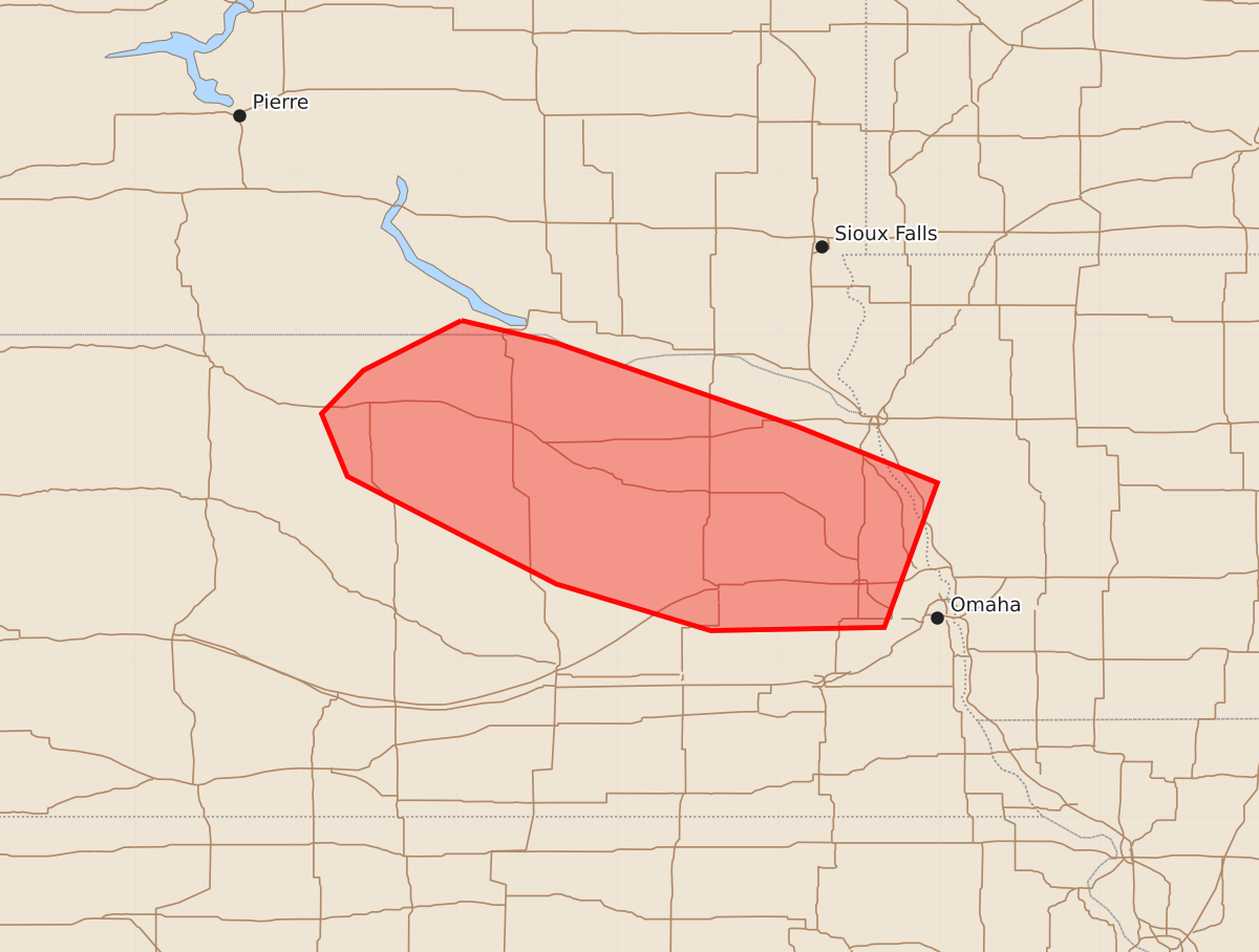
Summary
A cluster of severe thunderstorms capable of producing damaging wind gusts of 65 to 80 mph may impact parts of northeast and east central Nebraska through early Wednesday morning. The most intense activity is expected to approach areas near or west of Greater Omaha by approximately 5-6 AM CDT.
Product Text
000 ACUS11 KWNS 120635 SWOMCD SPC MCD 120635 IAZ000-NEZ000-SDZ000-120830- Mesoscale Discussion 1946 NWS Storm Prediction Center Norman OK 0135 AM CDT Wed Aug 12 2026 Areas affected...parts of northeast through east central Nebraska Concerning...Severe potential...Severe Thunderstorm Watch likely 572... Valid 120635Z - 120830Z Probability of Watch Issuance...80 percent SUMMARY...Ongoing developing severe storm cluster will probably be maintained at least a few more hours, and its possible it could approach areas near/west of Greater Omaha by 5-6 AM CDT, accompanied by the risk for damaging wind gusts. DISCUSSION...Though embedded within modest westerly deep-layer mean flow on the order of 20 kt, the ongoing intense supercell/compact cluster has been maintaining a southeastward propagation near 40 kts. This has been accompanied by an increase in severe gusts to the north/northwest of Ainsworth and O'Neill. On its current track, it appears likely to approach areas near/west of the Greater Omaha vicinity by 10-11Z. While there does appear potential to maintain continuing inflow of seasonably moist air supportive of sizable CAPE, convection continues to propagate into an environment with increased mid-level inhibition, with somewhat limited forcing for ascent. Activity will probably have to continue to grow upscale in the near term, accompanied by a substantively expanding and strengthening surface cold pool to provide continuing support for maintenance. This remains a bit uncertain, but appears possible. Regardless, a risk for severe winds will likely persist for at least a few more hours, requiring a new severe weather watch issuance. ..Kerr/Smith.. 08/12/2026 ...Please see www.spc.noaa.gov for graphic product... ATTN...WFO...FSD...OAX...GID...LBF... LAT...LON 43099897 42959838 42439688 42089601 41189634 41169742 41459838 42129968 42519984 42789958 43099897 MOST PROBABLE PEAK WIND GUST...65-80 MPH MOST PROBABLE PEAK HAIL SIZE...1.00-1.75 IN