Mesoscale Discussion 1288
Issued: · Valid: –
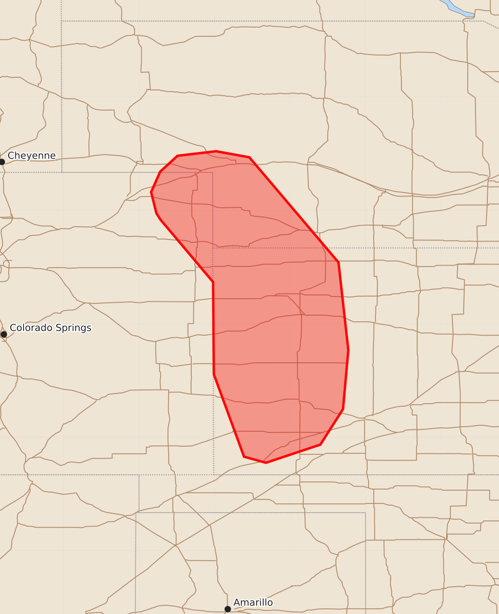
Summary
Severe thunderstorms capable of producing large hail and damaging wind gusts may develop across far southwestern Nebraska and western Kansas late Tuesday night. The storms could produce hail exceeding two inches in diameter and wind gusts between 65 and 80 mph.
Product Text
000 ACUS11 KWNS 240406 SWOMCD SPC MCD 240405 KSZ000-NEZ000-COZ000-240500- Mesoscale Discussion 1288 NWS Storm Prediction Center Norman OK 1105 PM CDT Tue Jun 23 2026 Areas affected...portions of far southwestern Nebraska into western Kansas Concerning...Severe potential...Watch possible Valid 240405Z - 240500Z Probability of Watch Issuance...60 percent SUMMARY...The severe threat may increase through the late evening, with severe wind/hail becoming more widespread through tonight east of Severe Thunderstorm Watch 385. A WW issuance may be needed pending favorable trends in storm intensification. DISCUSSION...Multicells/transient supercells have developed along the CO/NE border, at the terminus of an intensifying low-level jet. These storms are poised to track southeastward amid 2500+ J/kg MUCAPE and 60 kts of effective bulk shear. As such, any storms that can become sustained may pose a severe hail threat, a few stones of which could exceed 2 inches in diameter. Isolated to potentially scattered severe gusts are also possible, especially if an MCS begins to materialize sooner than expected. If storms continue to increase in coverage and intensity, a Severe Thunderstorm Watch may be needed. ..Squitieri/Smith.. 06/24/2026 ...Please see www.spc.noaa.gov for graphic product... ATTN...WFO...LBF...DDC...GLD...BOU...CYS... LAT...LON 40380272 40460277 40740284 41010272 41220249 41280198 41200154 39810036 38650023 37870030 37400060 37160132 37240161 38330201 39550202 40380272 MOST PROBABLE PEAK WIND GUST...65-80 MPH MOST PROBABLE PEAK HAIL SIZE...1.50-2.50 IN