Mesoscale Discussion 2068
Issued: · Valid: –
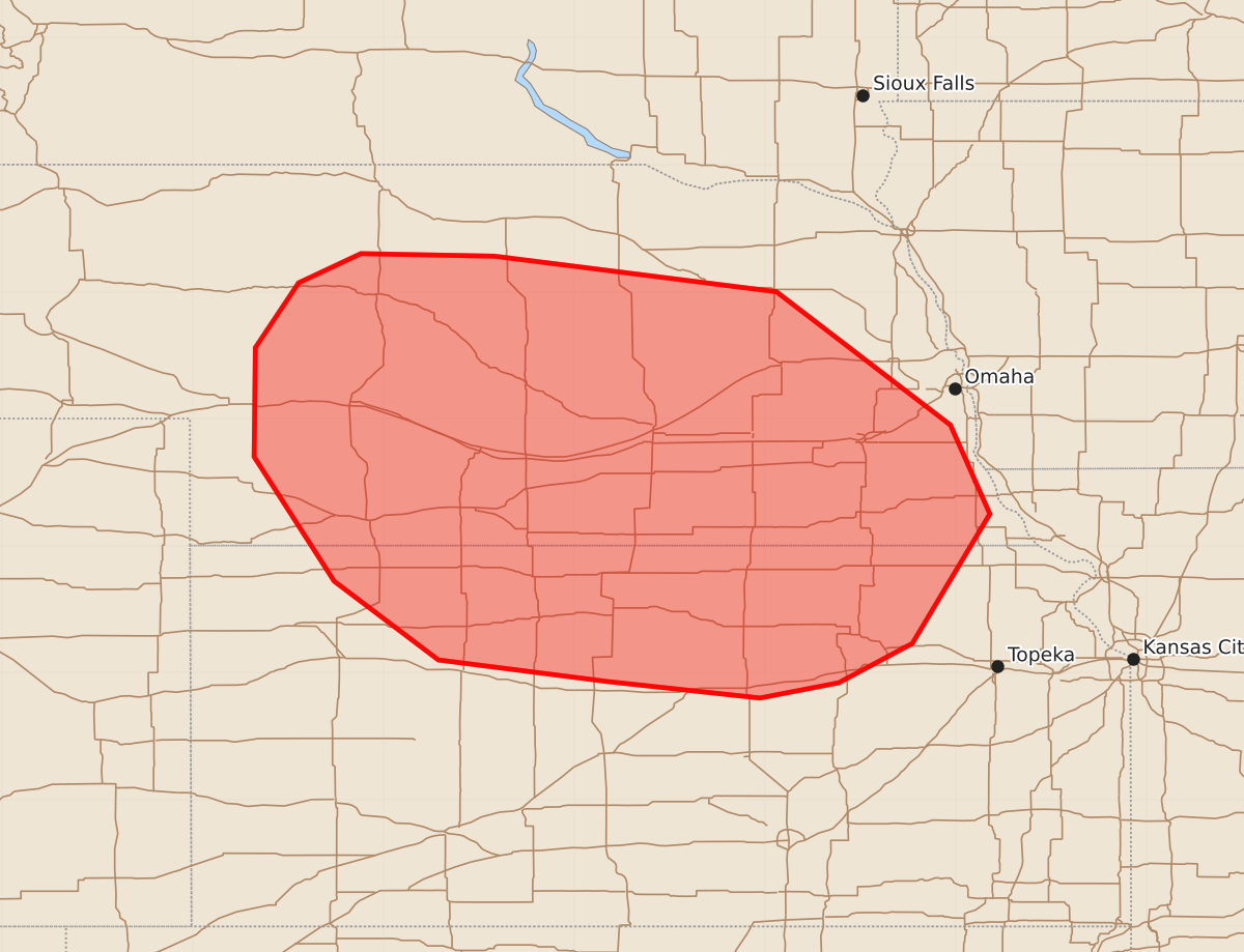
Summary
Isolated severe storms capable of producing large hail over two inches and wind gusts up to 80 mph are expected to increase across portions of Nebraska and northern Kansas during the mid to late afternoon.
Product Text
000 ACUS11 KWNS 211835 SWOMCD SPC MCD 211835 NEZ000-KSZ000-212030- Mesoscale Discussion 2068 NWS Storm Prediction Center Norman OK 0135 PM CDT Fri Aug 21 2026 Areas affected...portions of Nebraska into northern Kansas Concerning...Severe potential...Watch likely Valid 211835Z - 212030Z Probability of Watch Issuance...80 percent SUMMARY...The threat for at least isolated severe storms capable of large hail in excess of two inches and severe wind gusts up to 70-80 mph is expected to increase by mid to late afternoon. Convective trends are being monitored for one or multiple severe thunderstorm watches. DISCUSSION...Clusters of elevated thunderstorms have persisted so far today from the NE Sandhills into eastern NE with activity potentially being aided by a weak mid-level disturbance moving into northern NE. The 18Z OAX sounding suggests that storms are likely rooted above a relatively dry layer extending from just above the ground to 3-4 km AGL with the presence of steep mid-level lapse rates contributing to MUCAPE of 1500-2500+ J/kg. Considerable uncertainty still exists in storm evolution through the remainder of the afternoon. More recent storm development northeast of McCook, NE is occurring closer to a front-outflow composite boundary, ahead of which temperatures have warmed into the upper 80s to around 90 with steepening low-level lapse rates. That activity may intensify as it continues southeast into a hotter, more unstable air mass in place over northwest and north-central KS. Elsewhere, ongoing elevated thunderstorms from north-central into eastern NE may also intensify through mid/late afternoon amidst a kinematic environment featuring 40-50+ kt of deep-layer shear, which is conditionally supportive of supercell storm modes. The strongest storms will be capable of large hail, potentially in excess of two inches, as well as damaging wind gusts up to 70-80 mph. ..Mead/Smith.. 08/21/2026 ...Please see www.spc.noaa.gov for graphic product... ATTN...WFO...OAX...TOP...ICT...GID...LBF...DDC...GLD... LAT...LON 38939874 39100007 39720089 40700152 41560151 42070117 42300068 42289963 42009741 40959604 40259573 39239634 38929692 38809754 38939874 MOST PROBABLE PEAK TORNADO INTENSITY...UP TO 90 MPH MOST PROBABLE PEAK WIND GUST...65-80 MPH MOST PROBABLE PEAK HAIL SIZE...1.50-2.50 IN