Mesoscale Discussion 1577
Issued: · Valid: –
Summary
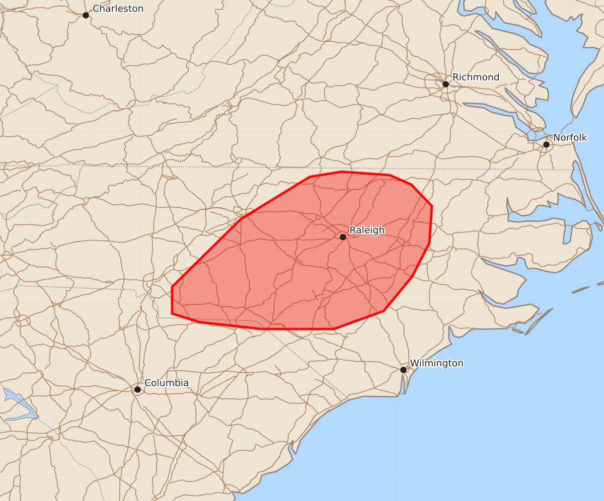
Damaging wind gusts of 45 to 60 mph are expected across portions of the North Carolina Piedmont through this evening.
Product Text
000 ACUS11 KWNS 102031 SWOMCD SPC MCD 102030 NCZ000-SCZ000-102230- Mesoscale Discussion 1577 NWS Storm Prediction Center Norman OK 0330 PM CDT Fri Jul 10 2026 Areas affected...portions of the North Carolina Piedmont Concerning...Severe potential...Watch unlikely Valid 102030Z - 102230Z Probability of Watch Issuance...20 percent SUMMARY...A locally greater risk for damaging wind gusts is likely to materialize across the North Carolina Piedmont over the next several hours. DISCUSSION...Aided by subtly enhanced mid-level flow associated with a remnant mid-level MCV, convection has loosely organized into a linear band across portions of central North Carolina over the past 1-2 hours, with several reports of damaging wind gusts (and a measured 43 kt wind gust) noted in the Charlotte vicinity. While further appreciable organization remains unlikely owing to weak deep-layer shear, this loosely organized band is impinging on a hot (temperatures approaching 100 F) and moist low-level air mass with both high PW and steep low-level lapse rates. This is expected to result in a locally greater threat for water-loaded downbursts and damaging wind gusts (largely in the 45-55 mph range, locally higher) across the North Carolina Piedmont through this evening. ..Chalmers/Smith.. 07/10/2026 ...Please see www.spc.noaa.gov for graphic product... ATTN...WFO...MHX...RAH...ILM...RNK...CAE...GSP... LAT...LON 36477903 36537866 36497810 36387785 36137761 35707764 35317784 34917817 34707875 34707959 34788031 34888063 35198063 35987983 36477903 MOST PROBABLE PEAK WIND GUST...UP TO 60 MPH