Mesoscale Discussion 1722
Issued: · Valid: –
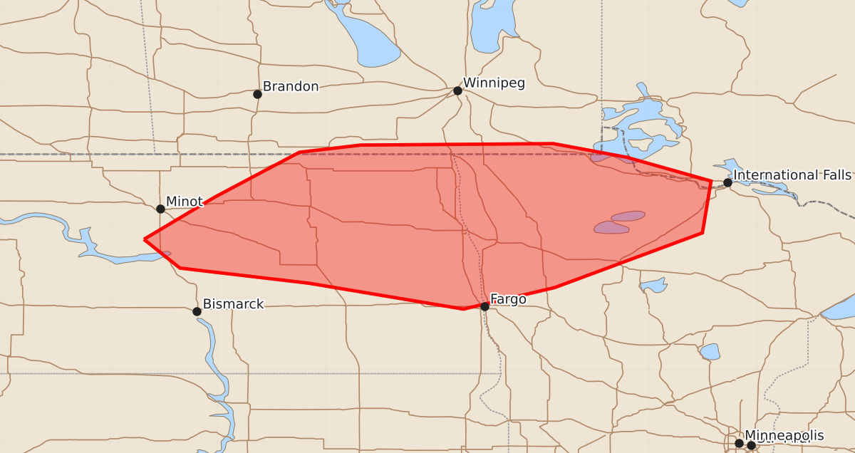
Summary
Severe storms, including potential supercells capable of producing large hail and tornadoes, are expected to develop across northern North Dakota and northwest Minnesota this afternoon and evening. These storms may bring significant hazards including very large hail and strong winds.
Product Text
000 ACUS11 KWNS 241936 SWOMCD SPC MCD 241936 MNZ000-NDZ000-242100- Mesoscale Discussion 1722 NWS Storm Prediction Center Norman OK 0236 PM CDT Fri Jul 24 2026 Areas affected...northern North Dakota into northwest Minnesota. Concerning...Severe potential...Watch possible Valid 241936Z - 242100Z Probability of Watch Issuance...60 percent SUMMARY...A watch will likely be needed by later this afternoon. DISCUSSION...Storms continue to develop along a differential heating zone/outflow boundary across northern Minnesota and southern Manitoba. Ongoing activity remains elevated, but CINH has started to erode across northeast North Dakota where temperatures are in the mid to upper 80s and dewpoints in the low to mid 70s. The southern periphery of a mid-level jet streak has overspread northern North Dakota with 45 to 50 knots being sampled around 6km by the MBX VAD. Ascent associated with this mid-level jet streak is approaching the region (as evidenced by mid-level ACCAS across north-central North Dakota. As this ascent overspreads the uncapped airmass farther east within the next 1 to 2 hours, expect surface-based storm development. Scattered storm development, including supercells, are expected through the afternoon and into the evening with a threat for all severe weather hazards. Most notably, very large hail is possible given supercell storm mode, strong instability, strong shear, steep lapse rates, and strong venting flow aloft. The greatest tornado threat will likely be across far northeast North Dakota into northern Minnesota where 70s F dewpoints are present, particularly in vicinity of the differential heating boundary. ..Bentley/Smith.. 07/24/2026 ...Please see www.spc.noaa.gov for graphic product... ATTN...WFO...DLH...FGF...BIS... LAT...LON 47810152 48400053 49029936 49129851 49149583 48959481 48629364 47909376 47149581 46849708 47209923 47410102 47810152 MOST PROBABLE PEAK TORNADO INTENSITY...85-110 MPH MOST PROBABLE PEAK WIND GUST...55-70 MPH MOST PROBABLE PEAK HAIL SIZE...2.00-3.50 IN