Mesoscale Discussion 1235
Issued: · Valid: –
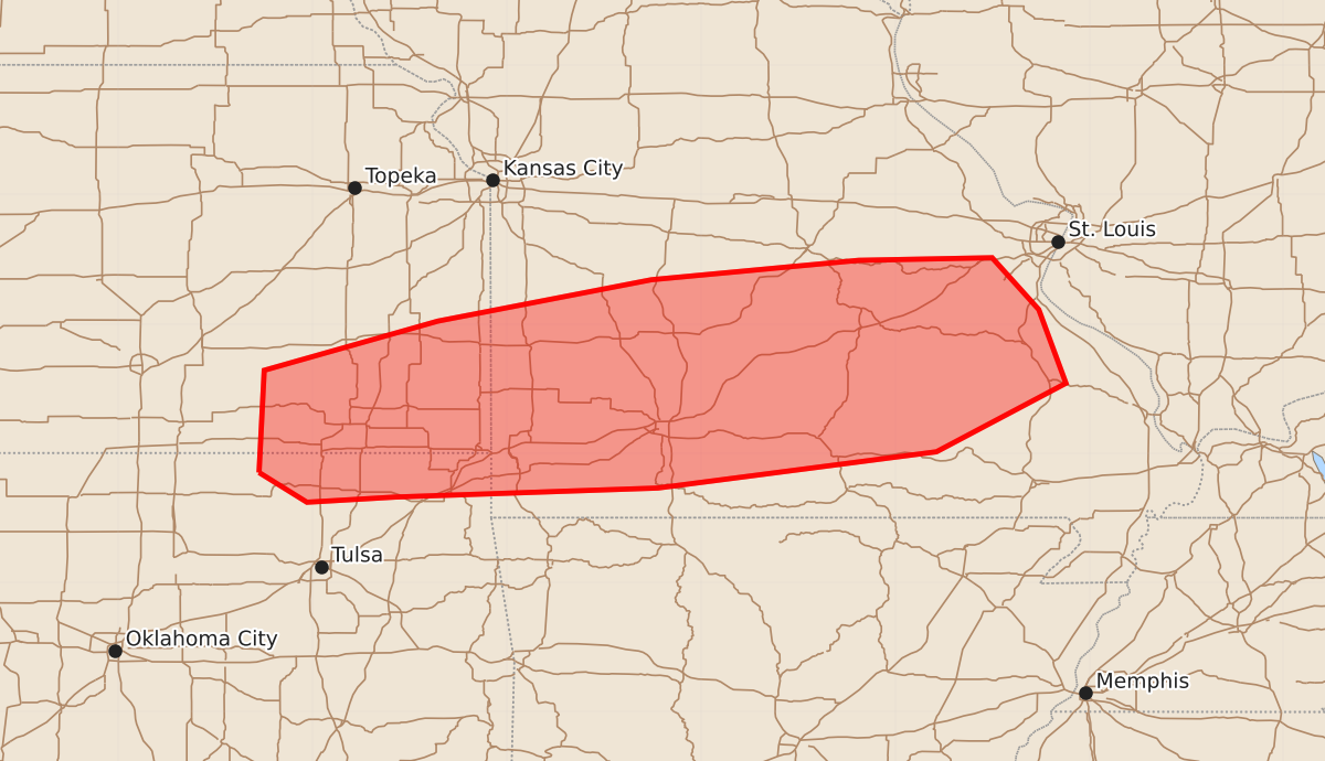
Summary
Severe thunderstorms are expected to develop across northeast Oklahoma, southeast Kansas, and southern Missouri this afternoon and evening. These storms may produce tornadoes, large hail, and damaging winds.
Product Text
000 ACUS11 KWNS 212221 SWOMCD SPC MCD 212221 MOZ000-KSZ000-OKZ000-212345- Mesoscale Discussion 1235 NWS Storm Prediction Center Norman OK 0521 PM CDT Sun Jun 21 2026 Areas affected...northeast Oklahoma...southeast Kansas...and much of southern Missouri Concerning...Severe potential...Watch likely Valid 212221Z - 212345Z Probability of Watch Issuance...80 percent SUMMARY...A severe thunderstorm is ongoing across southeast Kansas, with additional thunderstorms expected this afternoon/evening along and east of this storm. The overall environment will support severe potential with any of these storms and a watch will likely be needed. DISCUSSION...A remnant surface boundary, left over from the morning MCS/MCV (currently located over Illinois/Indiana) is currently located from northern Oklahoma northeast toward the greater St. Louis, MO, metro. Recent satellite imagery shows increasingly agitated cumulus development along this boundary, with an ongoing severe thunderstorm across southeast Kansas. Additional thunderstorms are expected to develop across the region, most likely developing east-northeast from ongoing convection across southeast Kansas. The environment along and south of this boundary is very unstable with MUCAPE in excess of 3000 J/kg with effective deep-layer shear on the order 40-50 knots. Thus, any thunderstorm that does develop will have the potential to become supercellular. The low-level wind field is currently fairly weak, which should limit the tornado potential in the near term across southeast Kansas and southwest Missouri. However, strong instability in the presence of a surface boundary will yield some tornado potential. With time, congealing outflows should result in an increasing wind threat as the storms move east-southeast. A watch will likely be needed. ..Marsh/Smith.. 06/21/2026 ...Please see www.spc.noaa.gov for graphic product... ATTN...WFO...PAH...LSX...SGF...EAX...TSA...ICT... LAT...LON 36859641 37649637 38029503 38349338 38499178 38519075 38119039 37549018 37019118 36739333 36669536 36629604 36859641 MOST PROBABLE PEAK TORNADO INTENSITY...85-110 MPH MOST PROBABLE PEAK WIND GUST...55-70 MPH MOST PROBABLE PEAK HAIL SIZE...1.50-2.50 IN