Mesoscale Discussion 1204
Issued: · Valid: –
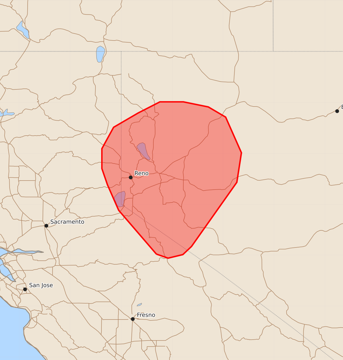
Summary
Strong to severe downburst winds with gusts up to 70 mph are expected across western Nevada and far northeast California through the early evening.
Product Text
000 ACUS11 KWNS 192021 SWOMCD SPC MCD 192021 NVZ000-CAZ000-192245- Mesoscale Discussion 1204 NWS Storm Prediction Center Norman OK 0321 PM CDT Fri Jun 19 2026 Areas affected...Western Nevada and portions of far northeast California Concerning...Severe potential...Watch unlikely Valid 192021Z - 192245Z Probability of Watch Issuance...20 percent SUMMARY...The potential for strong to severe downburst winds will increase through early evening across far northeast California and into western Nevada. Watch issuance is not expected. DISCUSSION...Cumulus has slowly been deepening along the Sierra Nevada per GOES imagery as early-day clouds clear and diurnal heating/upslope flow gradually increases. Based on regional radar imagery, several of the deeper towers are beginning to produce downdrafts, and occasional lightning flashes have been noted in GLM data over the past 20-30 minutes. These trends confirm the presence of very meager, but sufficient, buoyancy to support convection. GOES water-vapor imagery also depicts a low-level trough pivoting northward into NV, which will likely aid in ascent away from the terrain as well as provide some degree of mid-level cooling/destabilization - both of which will be favorable for the maintenance of convection through the late afternoon hours. As convection spreads northeast over the lower terrain, downdrafts will encounter a very deeply-mixed boundary layer characterized by nearly dry adiabatic 0-3 km lapse rates. This will promote substantial evaporative cooling and downdraft accelerations favorable for strong to severe downburst winds at the surface. Recent CAM guidance highlights this potential well and suggests that gusts may be as high as 60-70 mph. Despite the potential for severe winds, limited buoyancy should modulate the lifespan and intensity of convective cells and negate the need for a watch. ..Moore/Hart.. 06/19/2026 ...Please see www.spc.noaa.gov for graphic product... ATTN...WFO...LKN...REV...HNX... LAT...LON 38021931 38882005 39382027 39702038 40092038 40512015 40791967 41011924 41011878 40911829 40711795 40011764 39431773 38171862 38011879 37941908 38021931 MOST PROBABLE PEAK WIND GUST...55-70 MPH