Mesoscale Discussion 1769
Issued: · Valid: –
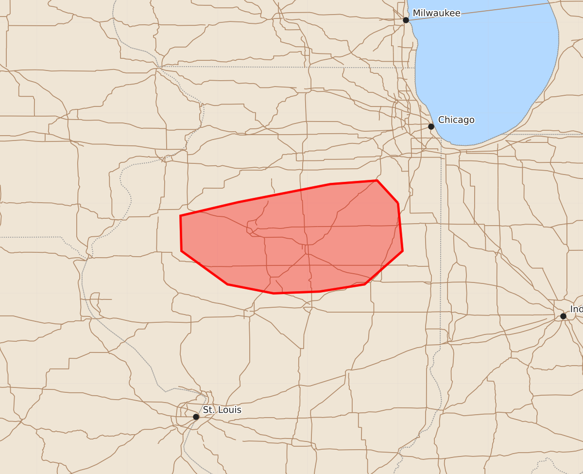
Summary
Isolated strong wind gusts and hail may accompany thunderstorms across portions of central Illinois this afternoon.
Product Text
000 ACUS11 KWNS 271959 SWOMCD SPC MCD 271958 ILZ000-272130- Mesoscale Discussion 1769 NWS Storm Prediction Center Norman OK 0258 PM CDT Mon Jul 27 2026 Areas affected...portions of central IL Concerning...Severe potential...Watch possible Valid 271958Z - 272130Z Probability of Watch Issuance...40 percent SUMMARY...Isolated strong wind gusts or hail could accompany stronger storms this afternoon. The need for a watch remains uncertain. DISCUSSION...Widely scattered thunderstorms are developing ahead of a surface trough across central IL within a very moist and unstable airmass. Strong northwesterly flow aloft is fostering 45+ kt effective shear magnitudes, which could support organized convection. However, large-scale ascent is nebulous across the area. Furthermore, looping visible satellite imagery shows a broadening cirrus shield over eastern IL associated with convection further east, and possible outflow/gravity waves spreading westward. It is uncertain if this may be helping initiate convection or will temper more robust development. While the overall thermodynamic/kinematic profiles across the area generally would support some severe risk, uncertainty is high. Trends will be monitored, and if intensity increases, WW 520 and 521 could be expanded westward, or a new watch issued if needed. ..Leitman/Hart.. 07/27/2026 ...Please see www.spc.noaa.gov for graphic product... ATTN...WFO...LOT...ILX...DVN... LAT...LON 41008800 40478795 40108837 40028887 40008938 40108989 40479040 40869041 41018977 41218875 41258823 41008800 MOST PROBABLE PEAK TORNADO INTENSITY...UP TO 90 MPH MOST PROBABLE PEAK WIND GUST...55-70 MPH MOST PROBABLE PEAK HAIL SIZE...1.00-1.75 IN