Day 1 Convective Outlook
Issued: · Valid: –
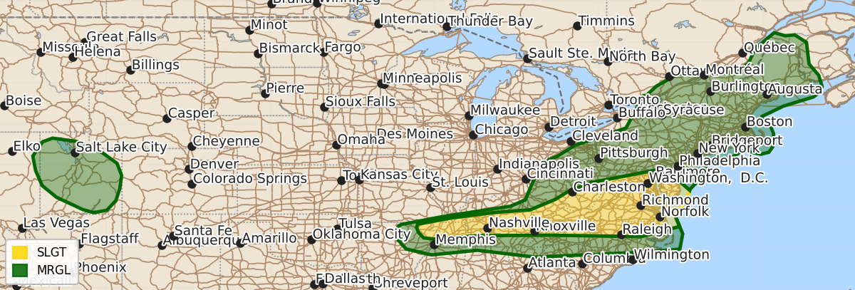
Summary
Scattered severe thunderstorms are possible this evening across the Tennessee Valley into the Mid-Atlantic, with damaging winds being the primary threat and a few tornadoes possible. Severe wind gusts are also expected in parts of the eastern Great Basin.
Product Text
000 ACUS01 KWNS 220056 SWODY1 SPC AC 220054 Day 1 Convective Outlook NWS Storm Prediction Center Norman OK 0754 PM CDT Tue Jul 21 2026 Valid 220100Z - 221200Z ...THERE IS A SLIGHT RISK OF SEVERE THUNDERSTORMS FROM THE LOWER OHIO VALLEY INTO THE TENNESSEE VALLEY AND PARTS OF THE MID-ATLANTIC... ...SUMMARY... Scattered severe storms remains possible this evening within the Tennessee Valley into the Mid-Atlantic. Damaging winds will be the primary risk, though a couple of tornadoes could occur with the most organized storms. ...Synopsis... A notable shortwave tough will continue moving through the Mid-Atlantic/Northeast into tonight. Convective overturning from earlier this afternoon has stabilized much of Pennsylvania/New York into New England. Forcing for ascent from the shortwave trough and the surface cold front will allow for isolated activity to persist tonight. Wind damage remains possible. An MCV is evident in northern Virginia. This will continue to promote storm development into parts of the Mid-Atlantic. Earlier activity has reduced buoyancy, but flow fields will increase as the trough continues to approach. Wind damage will continue to be the main threat, though a couple of tornadoes could occur with the strongest storms. MLCAPE of 3000+ J/kg is still present within the Tennessee Valley vicinity. A cluster of storms north of Nashville will pose the greatest risk for damaging winds as it tracks southward into the instability axis. Other strong to severe storms may impact parts of the eastern Great Basin. Severe wind gusts are the concern in that region. ..Wendt.. 07/22/2026 $$