Mesoscale Discussion 1716
Issued: · Valid: –
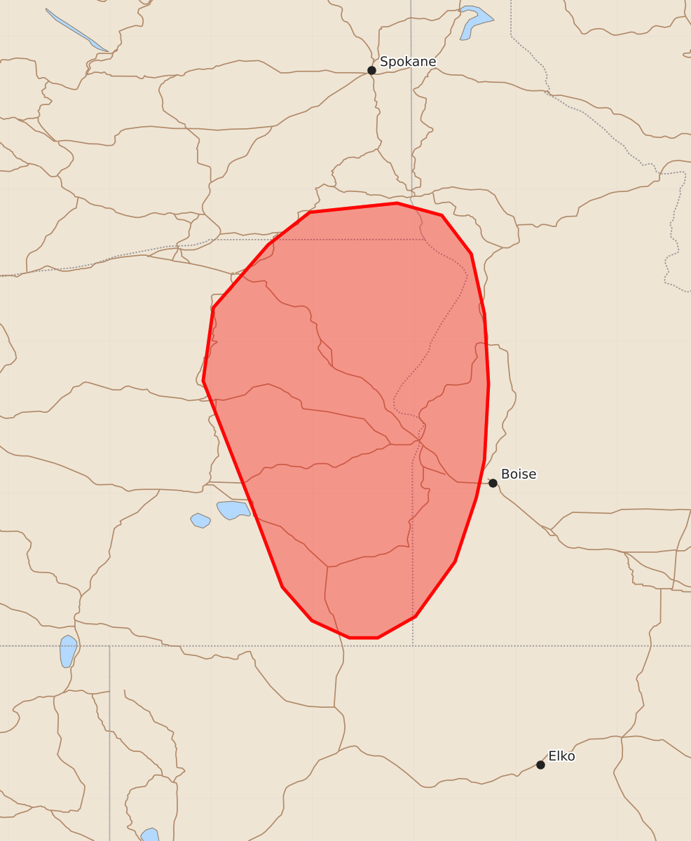
Summary
Isolated to scattered thunderstorms may produce severe wind gusts and large hail across portions of the Columbia Basin this afternoon.
Product Text
000 ACUS11 KWNS 231920 SWOMCD SPC MCD 231919 IDZ000-ORZ000-WAZ000-232115- Mesoscale Discussion 1716 NWS Storm Prediction Center Norman OK 0219 PM CDT Thu Jul 23 2026 Areas affected...portions of the Columbia Basin Concerning...Severe potential...Watch unlikely Valid 231919Z - 232115Z Probability of Watch Issuance...20 percent SUMMARY...Isolated to widely scattered, high-based thunderstorms are expected to develop along the high-terrain across portions of the Columbia Basin this afternoon. Isolated severe wind gusts and large hail may occur with these storms. DISCUSSION...Latest visible satellite imagery depicts a developing thunderstorm in far southeastern Oregon. As continued heating further deepens boundary layer mixing through the afternoon, additional convective initiation is expected along the high-terrain of eastern Oregon, far southwestern Washington, and western Idaho over the next 1-2 hours. Regional 18z observed soundings from BOI and OTX depicted increasingly well-mixed boundary layer profiles with steep low-to-mid level lapse rates. Enhanced southwesterly flow downstream of an upper low centered offshore of the Pacific Northwest was also sampled by these soundings and is supporting elongated, relatively straight hodographs. While available buoyancy is forecast to remain fairly weak (less than 1000 J/kg), a combination of weak supercell structures and storm clusters will favor an isolated threat for severe wind gusts (60-65 mph) and large hail. This threat is expected to remain too isolated for watch issuance, but trends will continue to be monitored. ..Chalmers/Smith.. 07/23/2026 ...Please see www.spc.noaa.gov for graphic product... ATTN...WFO...MSO...BOI...OTX...PDT... LAT...LON 43461639 42831660 42291699 42081736 42081764 42251801 42581830 43301857 44611908 45331898 45951844 46271803 46361717 46241673 45861644 45271631 44581627 43831631 43461639 MOST PROBABLE PEAK WIND GUST...55-70 MPH MOST PROBABLE PEAK HAIL SIZE...UP TO 1.25 IN