Mesoscale Discussion 1490
Issued: · Valid: –
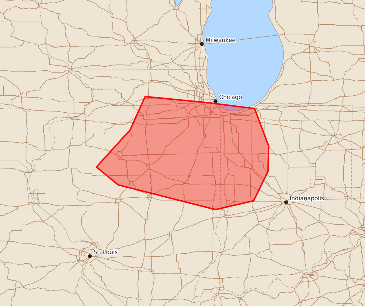
Summary
A cluster of strong to severe storms is expected to develop over central and north-central Illinois before moving into Indiana later this afternoon. These storms may produce damaging wind gusts of 55 to 70 mph.
Product Text
000 ACUS11 KWNS 041624 SWOMCD SPC MCD 041624 INZ000-ILZ000-041930- Mesoscale Discussion 1490 NWS Storm Prediction Center Norman OK 1124 AM CDT Sat Jul 04 2026 Areas affected...north-central Illinois into Indiana Concerning...Severe potential...Watch possible Valid 041624Z - 041930Z Probability of Watch Issuance...60 percent SUMMARY...A cluster of strong to severe storms is expected to develop after 18Z over central and north-central Illinois, moving into Indiana later this afternoon. Damaging gusts will be possible. DISCUSSION...Visible satellite and surface observations show a low and MCV moving out of eastern IA into northern IL. Analyzed streamlines show substantial convergence into northwest IL currently, with modest southerly winds ahead of this feature aiding warming/destabilization. Cooler air exists over southeast WI and northeast IL, but areas of heating and gradual warm advection may allow destabilization close to parts of the Chicago metro area. The 12Z ILX sounding shows high PWAT over 1.75", along with 25-35 kt midlevel westerlies. Overall storm motions will be toward the east, with a tendency for southeastward propagation. This could bring wind potential toward the Indianapolis area during the early evening. ..Jewell/Hart.. 07/04/2026 ...Please see www.spc.noaa.gov for graphic product... ATTN...WFO...IWX...IND...LOT...ILX...DVN... LAT...LON 40118965 40489010 41258940 41948909 41818777 41698682 40928653 40398654 39788684 39608762 39618768 40118965 MOST PROBABLE PEAK WIND GUST...55-70 MPH MOST PROBABLE PEAK HAIL SIZE...UP TO 1.25 IN