Mesoscale Discussion 2294
Issued: · Valid: –
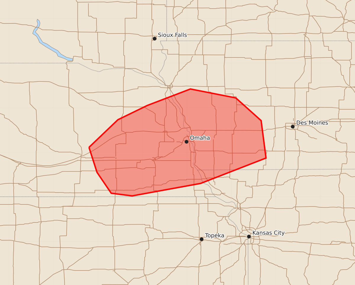
Summary
Severe thunderstorms capable of producing large hail, damaging wind gusts, and a possible tornado may develop across portions of eastern Nebraska and southwest Iowa through the evening.
Product Text
000 ACUS11 KWNS 142023 SWOMCD SPC MCD 142023 IAZ000-MOZ000-NEZ000-142230- Mesoscale Discussion 2294 NWS Storm Prediction Center Norman OK 0323 PM CDT Mon Sep 14 2026 Areas affected...portions of eastern Nebraska and southwest Iowa Concerning...Severe potential...Watch possible Valid 142023Z - 142230Z Probability of Watch Issuance...60 percent SUMMARY...Severe thunderstorm potential will increase through late afternoon across eastern Nebraska into western Iowa. Strong wind gusts, large hail, and a tornado or two will be possible through evening. DISCUSSION...Pockets of stronger heating behind earlier convection has allowed temperatures to rise into the 80s across southeast NE and far southwest IA. Additional heating and warm advection through the remainder of the afternoon will aid in further destabilization across the region. Northward extent of surface-based convective potential remains uncertain given a cooler boundary layer roughly along/north of the I-80 corridor. Moderate instability is expected to continue to spread north over the next few hours within a favorably sheared environment. Where stronger low-level warming occurs, surface-based convective potential will be greater. Low-level winds have remained backed/southeasterly, promoting 0-1 km SRH greater than 250 m2/s2 per regional VWP data. Storms will pose a risk for damaging gusts given strong background flow and steepened low-level lapse rates. If a semi-discrete supercell mode can be maintained and become surface-based, a tornado or two also will be possible. Modestly steep midlevel lapse rates and mildly cool (-9 to -7 C at 500 mb per 18z LBF and OAX RAOBS) temperatures aloft could also support large hail if storm mode remains favorable. While the overall scenario remains somewhat conditional on storm mode and whether or not surface-based convection can develop, the environment could support at couple of severe storms, and watch issuance may be needed in the next 1-2 hours. ..Leitman/Guyer.. 09/14/2026 ...Please see www.spc.noaa.gov for graphic product... ATTN...WFO...DMX...EAX...FSD...OAX...GID... LAT...LON 41119820 41739755 42059689 42429592 42229490 41719433 40879422 40309569 40029723 40089770 40559802 41119820 MOST PROBABLE PEAK TORNADO INTENSITY...100-125 MPH MOST PROBABLE PEAK WIND GUST...65-80 MPH MOST PROBABLE PEAK HAIL SIZE...1.00-1.75 IN