Mesoscale Discussion 2320
Issued: · Valid: –
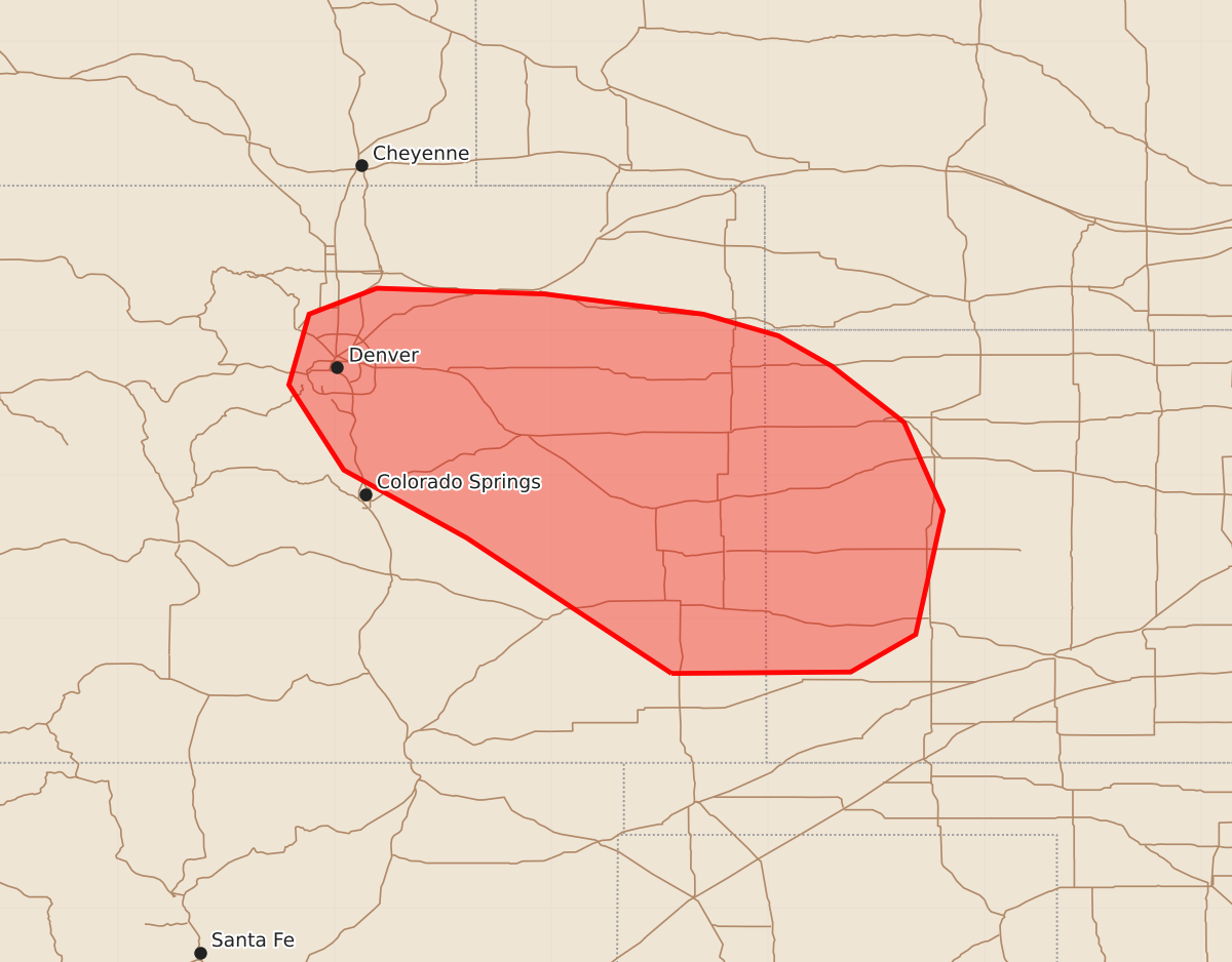
Summary
Severe thunderstorms capable of producing large hail and strong winds may develop across portions of eastern Colorado and western Kansas through 9:00 PM MDT. This activity is expected to occur this evening and overnight.
Product Text
000 ACUS11 KWNS 210201 SWOMCD SPC MCD 210201 KSZ000-COZ000-210400- Mesoscale Discussion 2320 NWS Storm Prediction Center Norman OK 0901 PM CDT Sun Sep 20 2026 Areas affected...portions of eastern Colorado and western Kansas Concerning...Severe Thunderstorm Watch 673... Valid 210201Z - 210400Z The severe weather threat for Severe Thunderstorm Watch 673 continues. SUMMARY...The initial severe threat has come to an end across the area. However, the region is being monitored for additional thunderstorm development, such as that suggested by latest numerical models. A new watch or the extension in space or time of the existing watch may become necessary before Severe Thunderstorm Watch #673 expires at 9:00 PM MDT. DISCUSSION...The long-track supercell that moved southeast across the Plains of Colorado this evening has dissipated bringing an end to the initial severe threat. This evolution was handled very well by high-resolution guidance. Attention is now focused on areas to the north where high-resolution guidance is indicating additional thunderstorm development is likely in the next 60-90 minutes. This scenario seems plausible given the persistent moist, easterly flow into the foothills expected this evening. Initial development may already be underway across portions of the Denver and Fort Collins metro areas based on MRMS CREF imagery. The overall environment will remain conducive for supercells with MUCAPE values in excess of 1000 J/kg, especially south and east of the Denver metro. Effective-layer shear remains more than sufficient for updraft rotation, with shear values between 40-55 knots across the Colorado Plains. Large hail and strong thunderstorm outflows will be possible with any sustained supercell this evening and overnight. Severe Thunderstorm Watch #673 is scheduled to expire at 9 PM MDT. The area will continue to be monitored for additional thunderstorm initiation and intensification. If it becomes apparent that additional severe thunderstorms are probable this evening, the region will either need a new Severe Thunderstorm Watch or an extension of Severe Thunderstorm Watch #673. A decision will be made regarding the need for a new watch, an extension of the existing watch, or cancellation of the existing watch within the hour. ..Marsh.. 09/21/2026 ...Please see www.spc.noaa.gov for graphic product... ATTN...WFO...DDC...GLD...PUB...BOU... LAT...LON 37620267 38560409 39030494 39620532 40110518 40290471 40250355 40110245 39960193 39750156 39360106 38750079 37890098 37630143 37620267 MOST PROBABLE PEAK TORNADO INTENSITY...UP TO 90 MPH MOST PROBABLE PEAK WIND GUST...55-70 MPH MOST PROBABLE PEAK HAIL SIZE...1.50-2.50 IN