Mesoscale Discussion 1196
Issued: · Valid: –
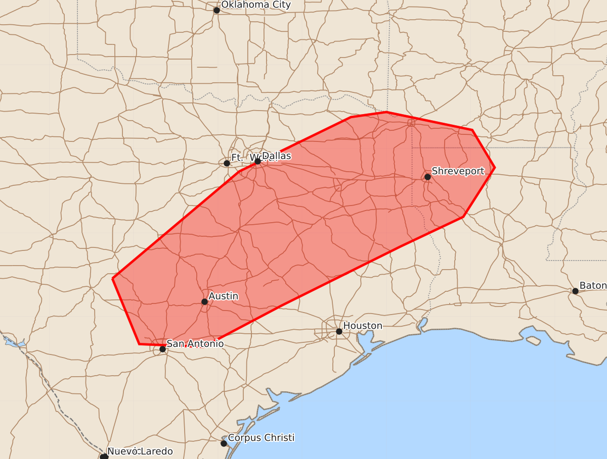
Summary
Severe wind gusts from thunderstorms are expected across the ArkLaTex region into south Texas from late morning through early afternoon. These storms may produce wind gusts between 55 and 70 mph.
Product Text
000 ACUS11 KWNS 191502 SWOMCD SPC MCD 191502 LAZ000-ARZ000-TXZ000-OKZ000-191700- Mesoscale Discussion 1196 NWS Storm Prediction Center Norman OK 1002 AM CDT Fri Jun 19 2026 Areas affected...ArkLaTex into south Texas Concerning...Severe potential...Watch unlikely Valid 191502Z - 191700Z Probability of Watch Issuance...20 percent SUMMARY...The potential for a few severe wind gusts is expected to increase by late morning into early afternoon. While a Severe Thunderstorm Watch is not currently anticipated, convective trends will be monitored for more organized cold pool development. DISCUSSION...Amidst a broader convective precipitation shield, a couple of more intense thunderstorm clusters are being observed as of 14:55 UTC. One is located west of Texarkana, with the other west of Lampasas, TX. The downstream air mass from the ArkLaTex into south TX is very moist with dewpoints in the mid 70s to around 80 with precipitable water values of around two inches. The robust moisture coincides with a narrow axis of 7-8 C/km mid-level lapse rates to yield MLCAPE of around 3000 J/kg as of 14 UTC. Filtered sunshine ahead of the ongoing storms is expected to support further air mass destabilization through the remainder of the morning into this afternoon. Latest short-term model guidance suggests that the leading edge of consolidated outflow will continue to support episodic storm intensification from the ArkLaTex into south TX, with the greatest signal for storm persistence being with the complex over the ArkLaTex. Given the presence of the very moist/unstable inflow air mass, the potential will exist for locally intense wet microbursts capable of a few severe wind gusts. Relatively weak deep-layer shear observed by regional VWPs is expected to limit the potential for broader-scale cold-pool organization and a resultant greater damaging wind threat. ..Mead.. 06/19/2026 ...Please see www.spc.noaa.gov for graphic product... ATTN...WFO...SHV...HGX...FWD...EWX...SJT... LAT...LON 30689938 32599712 33569513 33659450 33339297 32669257 31789313 31259425 30209636 29469776 29519890 30689938 MOST PROBABLE PEAK WIND GUST...55-70 MPH MOST PROBABLE PEAK HAIL SIZE...UP TO 1.25 IN