Mesoscale Discussion 1452
Issued: · Valid: –
Summary
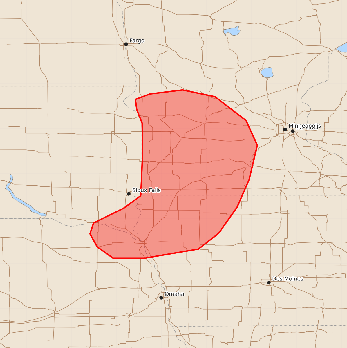
Severe thunderstorms are expected to spread into southwest Minnesota, northwest Iowa, and far northeast Nebraska over the next few hours, bringing the potential for damaging wind gusts up to 90 mph and large hail.
Product Text
000 ACUS11 KWNS 022253 SWOMCD SPC MCD 022252 MNZ000-IAZ000-NEZ000-SDZ000-030015- Mesoscale Discussion 1452 NWS Storm Prediction Center Norman OK 0552 PM CDT Thu Jul 02 2026 Areas affected...Southwest Minnesota...northwest Iowa...and far northeast Nebraska Concerning...Severe potential...Watch likely Valid 022252Z - 030015Z Probability of Watch Issuance...95 percent SUMMARY...Severe thunderstorms ongoing in South Dakota will likely spread east into central and southern Minnesota, and possibly far northern Iowa and far northeast Nebraska, in the next few hours. Watch issuance is expected soon. DISCUSSION...A band severe thunderstorms ongoing across eastern SD has a history of producing several severe wind gusts, including a gust to 90 mph. Southward development of this line is also noted in recent radar trends. Downstream, some lingering inhibition is noted across southern MN, and MLCAPE generally decreases with eastward extent. However, the presence of a well-established cold pool within the MCS and 35-40 knots of effective shear will likely compensate for the modest thermodynamic environment and support the potential for further strong/severe storms downstream through the evening hours. Watch issuance is expected soon to address this concern. ..Moore/Guyer.. 07/02/2026 ...Please see www.spc.noaa.gov for graphic product... ATTN...WFO...MPX...DMX...FGF...FSD...OAX...ABR... LAT...LON 45429655 45659658 45779626 45869553 45719481 45189412 44639387 43879405 43259432 42679473 42329518 42129636 42129708 42379743 42669759 42909751 43239684 43509647 43529646 44459642 45129643 45429655 MOST PROBABLE PEAK TORNADO INTENSITY...UP TO 90 MPH MOST PROBABLE PEAK WIND GUST...75-90 MPH MOST PROBABLE PEAK HAIL SIZE...1.00-1.75 IN