Mesoscale Discussion 2141
Issued: · Valid: –
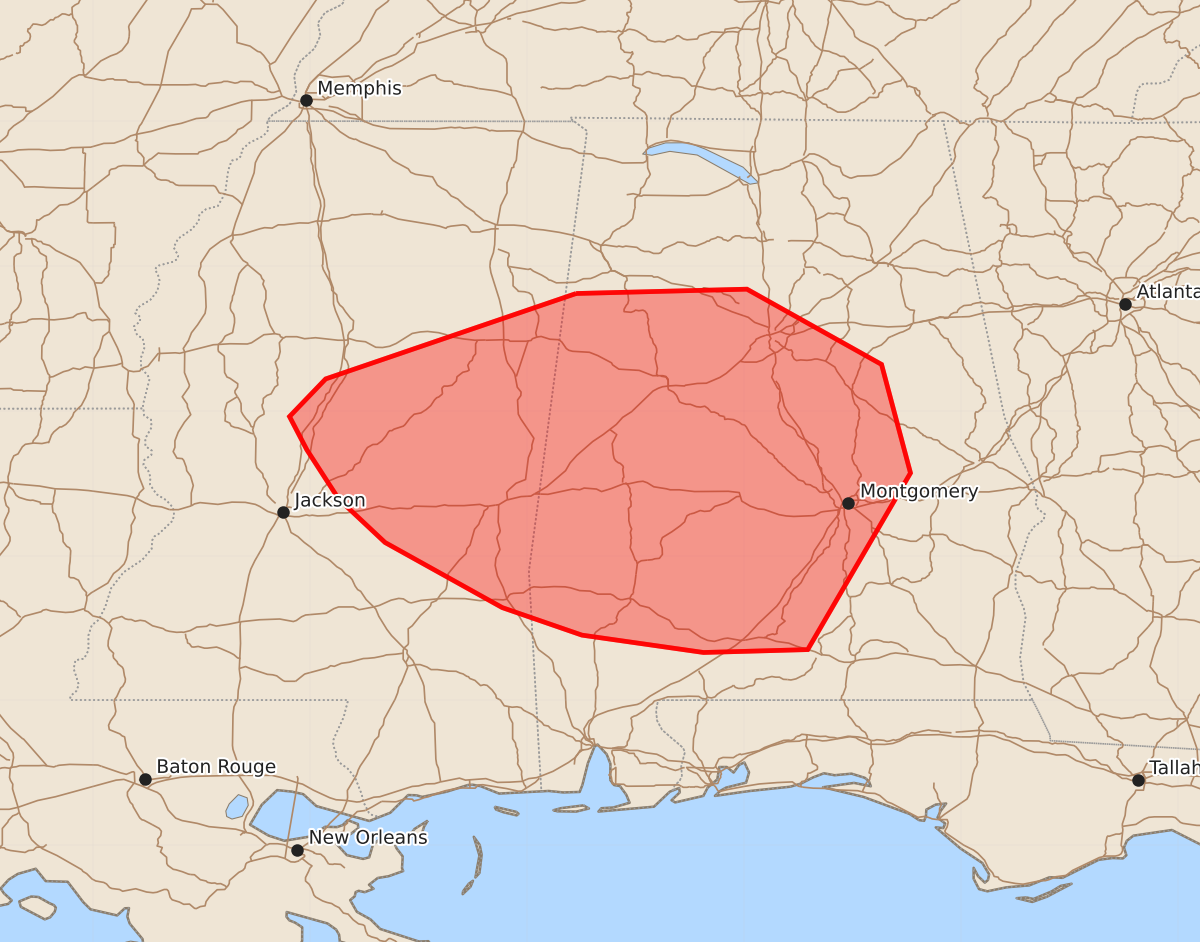
Summary
Isolated damaging wind gusts are possible this evening as thunderstorms move across eastern Mississippi into central Alabama.
Product Text
000 ACUS11 KWNS 262154 SWOMCD SPC MCD 262153 ALZ000-MSZ000-270000- Mesoscale Discussion 2141 NWS Storm Prediction Center Norman OK 0453 PM CDT Wed Aug 26 2026 Areas affected...portions of eastern Mississippi into central Alabama Concerning...Severe potential...Watch unlikely Valid 262153Z - 270000Z Probability of Watch Issuance...20 percent SUMMARY...Isolated damaging gusts are possible this evening with a cluster of thunderstorms ongoing across MS and AL. Further clustering is expected as storms move south/southeast. DISCUSSION...As of 2150 UTC, regional radar imagery showed a cluster of strong to severe storms ongoing near the MS/AL border. Over the last hour, consolidating outflows have allowed for additional storm development to take place, bolstering convective intensity within the ongoing cluster. The warm and very humid air mass remains strongly unstable ahead of these storms and should continue to maintain their intensity into this evening. Further aided by weak ascent at the base of a broad upper trough, storm coverage is likely to increase over the next couple of hours given little inhibition. Flow aloft remains weak which will support only modest storm organizational and a multicellular mode. Expectations are for outflow to continue to consolidate as it moves south/southeast across eastern MS into central/southern AL. High PWATs above 2.5 inches will support water-loaded downdrafts within the more intense cores, potentially capable of occasional damaging gusts. The primary limiting factor remains to be the modest deep-layer shear. This should limit storm organization with only intermittent intensification expected. While an isolated severe risk is possible this evening a watch appears unlikely at this time. ..Lyons/Smith.. 08/26/2026 ...Please see www.spc.noaa.gov for graphic product... ATTN...WFO...BMX...MOB...MEG...JAN... LAT...LON 33818816 33848698 33328605 32578585 31358656 31338728 31458812 31648867 32098948 32398980 32739002 32969014 33228989 33818816 MOST PROBABLE PEAK WIND GUST...UP TO 60 MPH MOST PROBABLE PEAK HAIL SIZE...UP TO 1.25 IN