Mesoscale Discussion 1525
Issued: · Valid: –
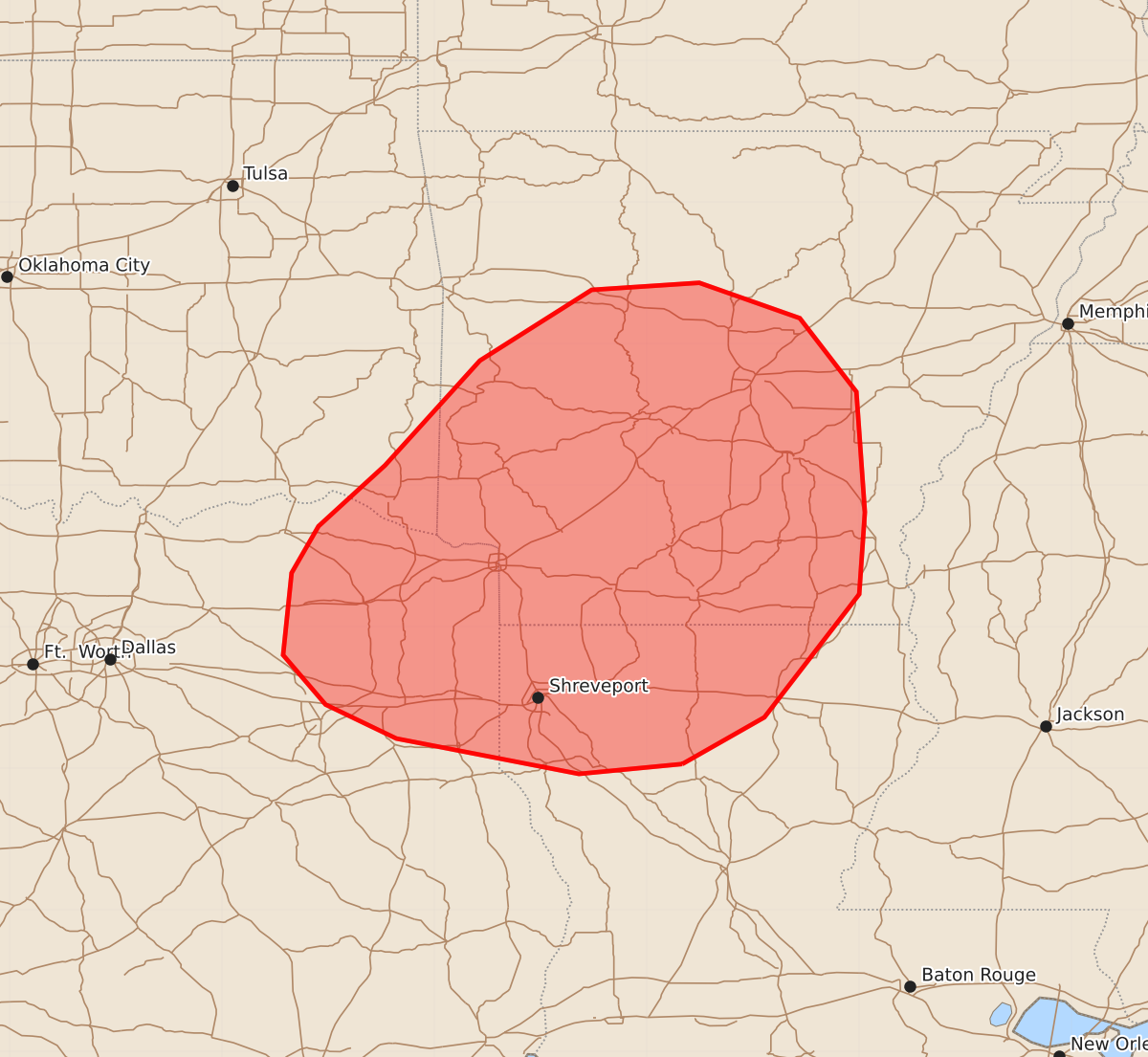
Summary
Damaging thunderstorm winds and sporadic severe hail may develop across parts of southern and central Arkansas, northern Louisiana, and northeast Texas during the afternoon. Expected wind gusts could reach 55 to 70 mph with hail up to 1.25 inches.
Product Text
000 ACUS11 KWNS 062018 SWOMCD SPC MCD 062017 ARZ000-LAZ000-TXZ000-OKZ000-062245- Mesoscale Discussion 1525 NWS Storm Prediction Center Norman OK 0317 PM CDT Mon Jul 06 2026 Areas affected...Parts of southern/central AR...northern LA...and northeast TX Concerning...Severe potential...Watch possible Valid 062017Z - 062245Z Probability of Watch Issuance...40 percent SUMMARY...The risk of damaging thunderstorm wind gusts will gradually increase through the afternoon. Convective trends are being monitored, and a watch could eventually be warranted. DISCUSSION...Large-scale forcing for ascent preceding a compact midlevel low/vort max is aiding in the development of thunderstorms along a weak surface boundary in northern/central AR, with additional development within a broad low-level confluence zone extending from northeast TX into central AR. Within this zone, strong diurnal heating/destabilization of a moist PBL (lower 70s dewpoints) beneath relatively steep midlevel lapse rates (sampled by SHV 18Z sounding) is contributing to around 3000-3500 J/kg MLCAPE. This increasing buoyancy and diurnally steepening low-level lapse rates will be favorable for damaging downbursts with the stronger storms that evolve. Given weak deep-layer shear, thunderstorms should generally remain disorganized/outflow dominant. However, the aforementioned buoyancy and focused area of deep-layer ascent could promote several loosely organized clusters capable of scattered damaging winds and sporadic severe hail with time. Convective trends (especially a tendency for clustering) are being monitored, and a watch could eventually be warranted for parts of the area. ..Weinman/Hart.. 07/06/2026 ...Please see www.spc.noaa.gov for graphic product... ATTN...WFO...JAN...LZK...SHV...TSA...FWD... LAT...LON 32039275 31969348 32219477 32459527 32809557 33389551 33719532 34149485 34889418 35389339 35439263 35189192 34669152 33819146 33239150 32369217 32039275 MOST PROBABLE PEAK WIND GUST...55-70 MPH MOST PROBABLE PEAK HAIL SIZE...UP TO 1.25 IN