Mesoscale Discussion 1768
Issued: · Valid: –
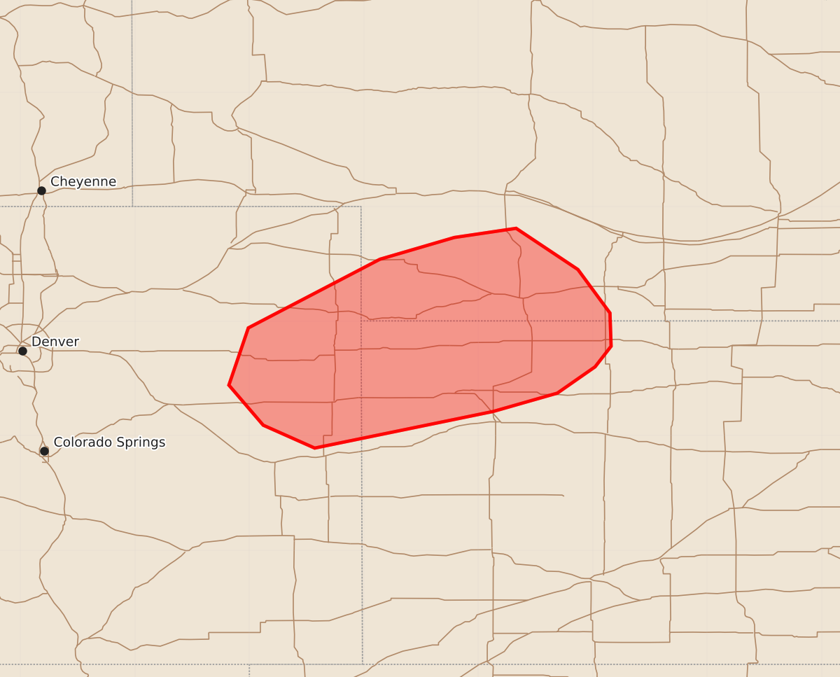
Summary
Strong thunderstorms capable of producing severe wind gusts are possible across northeast Colorado, northwest Kansas, and southwest Nebraska through this evening. Expected peak wind gusts may reach 55 to 70 mph.
Product Text
000 ACUS11 KWNS 271942 SWOMCD SPC MCD 271941 KSZ000-NEZ000-COZ000-272145- Mesoscale Discussion 1768 NWS Storm Prediction Center Norman OK 0241 PM CDT Mon Jul 27 2026 Areas affected...Northeast Colorado into northwest Kansas and southwest Nebraska Concerning...Severe potential...Watch possible Valid 271941Z - 272145Z Probability of Watch Issuance...40 percent SUMMARY...Thunderstorm development across parts of the central High Plains appears probable in the coming hours. Deep boundary-layer mixing coupled with ample buoyancy will likely yield a few strong/severe thunderstorms capable of severe wind gusts. Trends will be monitored for the need for watch issuance. DISCUSSION...Latest GOES imagery and regional radars show gradual deepening of cumulus and shallow convective showers/weak thunderstorms across far eastern CO into adjacent portions of northwest KS and southwest NE. This activity appears to largely be driven by very weak ascent along and north of a stalled baroclinic zone and ahead of a weak mid-level disturbance. Residual capping is slowly eroding across the region as temperatures breach 100 F. As temperatures continue to warm, thunderstorm coverage and intensity may increase, though confidence on overall storm coverage is limited given the weak forcing for ascent. Regardless, thunderstorms that can develop will likely mature within a thermodynamic environment featuring MLCAPE values upwards of 1500-2500 J/kg and deep boundary-layer mixing up to 2-3 km, which should favor robust updrafts and accelerating downdrafts. Consequently, strong to severe winds will be possible, and modest deep-layer wind shear may support some storm organization and the potential for loosely organized clusters. Limited confidence on thunderstorm coverage casts uncertainty on the need for watch issuance, but trends will continue to be monitored. ..Moore/Hart.. 07/27/2026 ...Please see www.spc.noaa.gov for graphic product... ATTN...WFO...GID...LBF...GLD...BOU... LAT...LON 39210087 38890243 39090288 39440318 39940301 40540186 40730121 40810067 40450013 40079985 39789984 39609998 39370031 39210087 MOST PROBABLE PEAK WIND GUST...55-70 MPH