Mesoscale Discussion 1816
Issued: · Valid: –
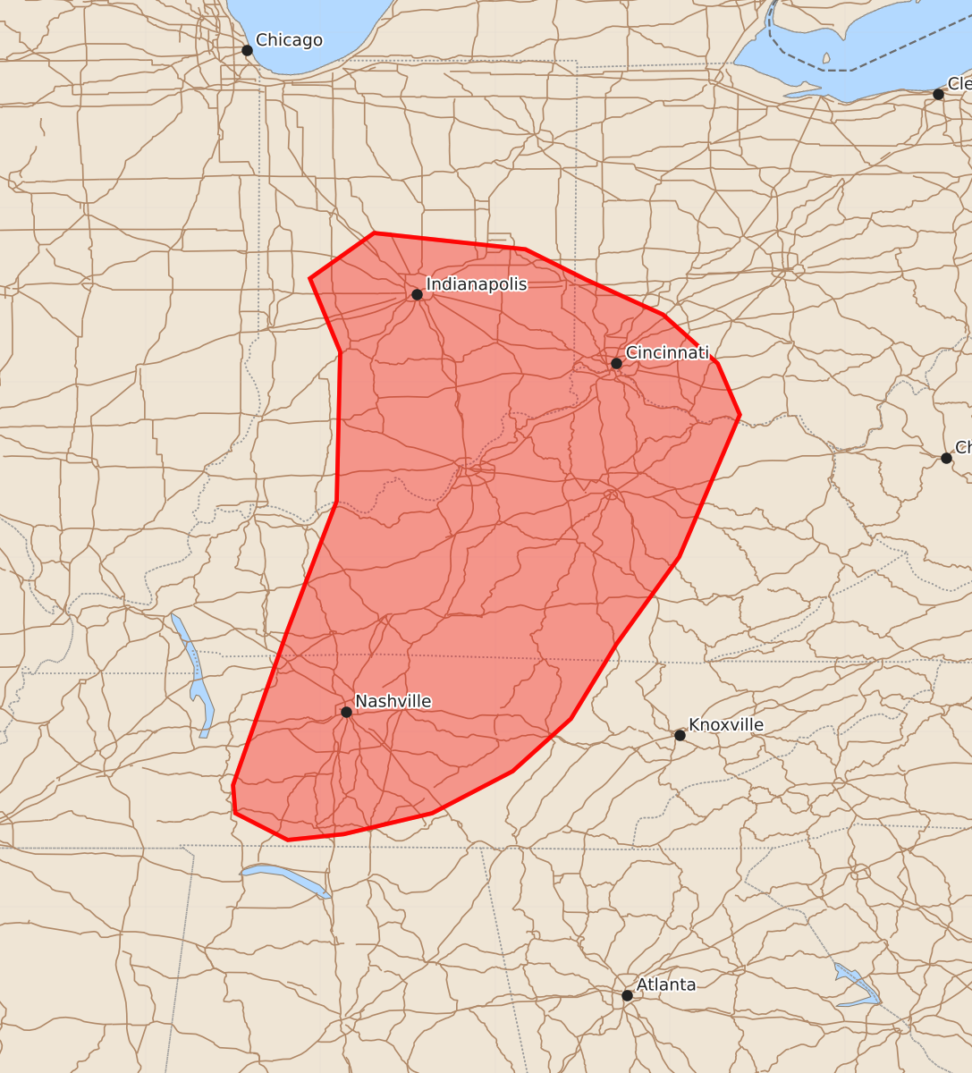
Summary
Scattered thunderstorms are expected to develop across parts of southern Indiana, Ohio, central Kentucky, and middle Tennessee this afternoon, bringing a risk of damaging wind gusts and a few tornadoes. These storms may include both clusters and supercells with varying levels of severity.
Product Text
000 ACUS11 KWNS 011731 SWOMCD SPC MCD 011731 KYZ000-OHZ000-TNZ000-INZ000-012000- Mesoscale Discussion 1816 NWS Storm Prediction Center Norman OK 1231 PM CDT Sat Aug 01 2026 Areas affected...portions of southern Indiana and Ohio into central Kentucky and middle Tennessee Concerning...Severe potential...Watch possible Valid 011731Z - 012000Z Probability of Watch Issuance...40 percent SUMMARY...Scattered thunderstorms are expected to develop ahead of a cold front and surface cyclone this afternoon across the OH/TN Valleys. A mixed mode of clusters and supercell structures could pose a risk for damaging gusts and a couple of tornadoes. A WW is possible, but uncertain. DISCUSSION...As of 1730 UTC visible and radar imagery showed showers and incipient thunderstorms intensifying along a broad frontal zone over the lower OH valley. Diffuse heating amid lingering clouds ahead of the front and occluded surface cyclone have raised surface temperatures into upper 70s to low 80s F in a very moist surface air mass. While overall lapse rate profiles are modest, the heating and weak ascent from the associate upper low overspreading the area is supporting continuing destabilization this afternoon with MLCAPE of 1000-2000 J/kg expected. Storm coverage is forecast to increase from IN, southward across KY and into parts of OH and middle TN this afternoon. A belt of stronger westerly flow aloft is supporting 30-35 kt of effective shear and modest low-level hodograph curvature evident on area VADs. This suggests a mix of organized multicells and transient supercell structures is likely. The high PWATs will favor water-loading of the downdrafts and some damaging gusts potential, especially for cells that can cluster. The tornado risk is less clear, but focused low-level buoyancy, plentiful ambient vertical vorticity and 0-500m SRH of 75-150 m2/s2 could support a couple of tornadoes with any potential supercells. This could be locally focused where the most robust surface heating is occurring, and where low-level flow remains backed along portions of the OH river in southern IN northern KY and southwest OH. Given the expected increase in thunderstorms with some risk for damaging gusts and a couple tornadoes, a WW is being considered. However, the lingering cloud cover and nebulous forcing lend low confidence on timing and where the greatest threat may occur. ..Lyons/Mosier.. 08/01/2026 ...Please see www.spc.noaa.gov for graphic product... ATTN...WFO...MRX...JKL...ILN...LMK...OHX...IND...HUN...PAH... LAT...LON 36858729 37988686 39268683 39898709 40288654 40148524 39888472 39588406 39168359 38728340 37508392 36758446 36118485 35668535 35308604 35128680 35078728 35308773 35548775 36858729 MOST PROBABLE PEAK TORNADO INTENSITY...85-110 MPH MOST PROBABLE PEAK WIND GUST...55-70 MPH