Mesoscale Discussion 1770
Issued: · Valid: –
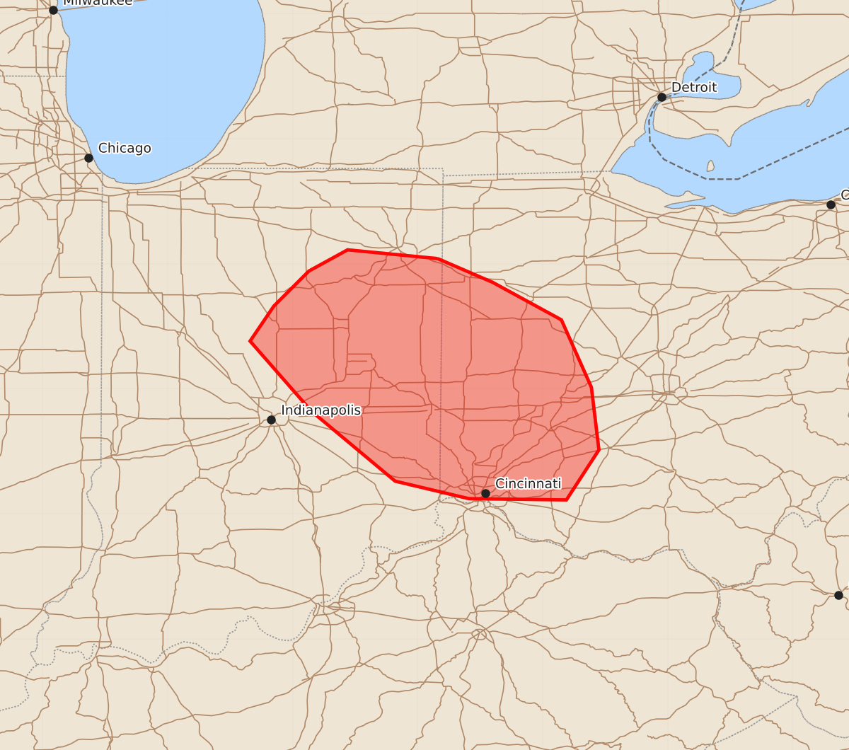
Summary
Severe thunderstorms with the potential for damaging wind gusts and large hail may develop across eastern Indiana and move into western Ohio this afternoon. These storms could produce peak wind gusts between 55 and 70 mph and hail up to 1.75 inches.
Product Text
000 ACUS11 KWNS 272049 SWOMCD SPC MCD 272048 OHZ000-INZ000-272245- Mesoscale Discussion 1770 NWS Storm Prediction Center Norman OK 0348 PM CDT Mon Jul 27 2026 Areas affected...portions of eastern IN into western OH Concerning...Severe potential...Watch possible Valid 272048Z - 272245Z Probability of Watch Issuance...60 percent SUMMARY...Severe potential could spread southeast into parts of western Ohio over the next couple of hours. Trends are being monitored and a downstream severe thunderstorm watch could be needed. DISCUSSION...A cluster of storms over central Indiana have shown some indications of intensification over the past 30 minutes both in radar imagery and based on recent local storm reports relaying gusts near 60 mph and localized wind damage. This activity will continue to spread east/southeast along a strong instability gradient within enhanced northwesterly flow aloft. While the environment overall is favorable for organized severe convection, uncertainty remains given persistent cloud cover across western OH and some indications of continued capping per SPC mesoanalysis. Nevertheless, temperatures in the 80s across far southwest OH and dewpoints in the low/mid 70s F could support at least sporadic strong gusts. Trends will be monitored for possible watch issuance over the next 1-2 hours. ..Leitman/Hart.. 07/27/2026 ...Please see www.spc.noaa.gov for graphic product... ATTN...WFO...ILN...IWX...IND... LAT...LON 41048484 40858440 40558385 40018361 39518355 39118381 39128459 39268518 39828585 40388634 40668615 40948587 41118556 41048484 MOST PROBABLE PEAK TORNADO INTENSITY...UP TO 90 MPH MOST PROBABLE PEAK WIND GUST...55-70 MPH MOST PROBABLE PEAK HAIL SIZE...1.00-1.75 IN