Mesoscale Discussion 1954
Issued: · Valid: –
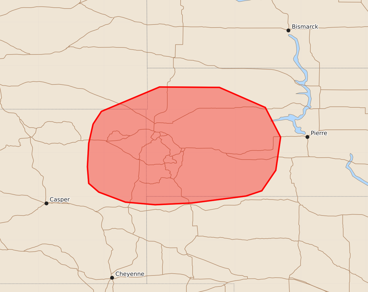
Summary
Scattered thunderstorms will develop through this afternoon across portions of northeastern Wyoming, far southeastern Montana, and western South Dakota, bringing a threat of large to very large hail and severe wind gusts.
Product Text
000 ACUS11 KWNS 121845 SWOMCD SPC MCD 121845 SDZ000-NEZ000-MTZ000-WYZ000-122045- Mesoscale Discussion 1954 NWS Storm Prediction Center Norman OK 0145 PM CDT Wed Aug 12 2026 Areas affected...portions of northeastern Wyoming and far southeastern Montana into the Black Hills and western South Dakota Concerning...Severe potential...Watch likely Valid 121845Z - 122045Z Probability of Watch Issuance...80 percent SUMMARY...Scattered thunderstorms will develop eastward into the Black Hills/western South Dakota vicinity through this afternoon, bringing a threat for large to very large hail and severe wind gusts. DISCUSSION...Latest radar imagery depicts a developing supercell in close proximity to a surface low across northeastern Wyoming. Aided by weak ascent ahead of a mid-level perturbation and easterly, upslope flow (surface dewpoints ranging from the low 60s F to near 70 farther east), convection will expand in coverage through the afternoon as it evolves eastward into the Black Hills/western South Dakota vicinity. While the 18z UNR observed sounding depicted lingering inhibition, filtered diurnal heating should gradually reduce inhibition through the afternoon. For ongoing/developing convection, steep mid-level lapse rates (8+ C/km), 40-50+ kts of effective shear, and relatively straight, elongated hodographs will support supercells as the initial storm mode, with large to very large hail the primary hazard. Increasing storm coverage lends uncertainty to how long discrete supercells will be maintained, with eventual upscale growth/cluster development expected to yield a transition towards severe wind gusts as the primary hazard. Should a discrete mode be maintained for longer, however, very large hail to 3 inches in diameter would be possible. A Severe Thunderstorm Watch will likely be needed for a portion of the area within the hour. ..Chalmers/Thompson.. 08/12/2026 ...Please see www.spc.noaa.gov for graphic product... ATTN...WFO...ABR...LBF...UNR...CYS...BYZ... LAT...LON 44660525 44950506 45510373 45500236 45040131 44360096 43600107 43130139 43010175 42850299 42810383 42870451 43100512 43300535 43680538 44220535 44660525 MOST PROBABLE PEAK WIND GUST...65-80 MPH MOST PROBABLE PEAK HAIL SIZE...2.00-3.50 IN